
IMAGES TAKEN NEAR TO
Havenside, SKEGNESS, PE24 4ET
Introduction
This page details the photographs taken nearby to Havenside, PE24 4ET by members of the Geograph project.
The Geograph project started in 2005 with the aim of publishing, organising and preserving representative images for every square kilometre of Great Britain, Ireland and the Isle of Man.

There are currently over 7.5m images from over14,400 individuals and you can help contribute to the project by visiting https://www.geograph.org.uk
Image Map
Images are licensed for reuse under creativecommons.org/licenses/by-sa/2.0
Notes
- Clicking on the map will re-center to the selected point.
- The higher the marker number, the further away the image location is from the centre of the postcode.
Image Listing (216 Images Found)
Images are licensed for reuse under creativecommons.org/licenses/by-sa/2.0
Image
Details
Distance
1

By The River Steeping
Near Wainfleet Hall
Image: © Neil Theasby
Taken: 13 Sep 2020
0.03 miles
2

Magdalen College Museum
The museum is on the upper floor of the Magdalen College School.
St John Street, Wainfleet
Tel:01754 881548
Open: Easter to End of September
Tuesday, Thursday, Friday, Saturday, Sunday
Plus Bank Holidays
1.30pm. to 4.30pm.
also includes our Tea room, walled-in garden and Library.
Image: © Dave Hitchborne
Taken: 13 May 2004
0.04 miles
3

Wainfleet and the Tofts, with the A52 running down the east side of the Tofts: aerial 2017 (2)
Steeping River, and A52 (left) to Boston.
For information on the geology, history and geography of this fenland area, its saltworks and its drainage see: https://www.dur.ac.uk/east-lincs-history and https://archive.org/stream/cu31924014023893#page/n3/mode/2up
For the Tofts in particular see: https://www.dur.ac.uk/east-lincs-history/investigations/from-1100-1500-the-coast/#2.2.3.5 and https://www.dur.ac.uk/east-lincs-history/investigations/the-rural-economy-between-the-fen-and-the-sea/#2.4.5.4
Image: © Chris
Taken: 23 Apr 2017
0.07 miles
4

Wainfleet and the Tofts, with the A52 running down the east side of the Tofts: aerial 2017 (3)
Steeping River, and A52 (to Boston) running upwards from centre to left.
For information on the geology, history and geography of this fenland area, its saltworks and its drainage see: https://www.dur.ac.uk/east-lincs-history and https://archive.org/stream/cu31924014023893#page/n3/mode/2up
For the Tofts in particular see: https://www.dur.ac.uk/east-lincs-history/investigations/from-1100-1500-the-coast/#2.2.3.5 and https://www.dur.ac.uk/east-lincs-history/investigations/the-rural-economy-between-the-fen-and-the-sea/#2.4.5.4
Image: © Chris
Taken: 23 Apr 2017
0.07 miles

6
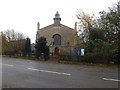
All Saints Parish Church, Wainfleet All Saints
Image: © Richard Hoare
Taken: 15 Nov 2014
0.08 miles
7

Cut bench mark and bolt on Wainfleet All Saints' Church
Cut mark with bolt to its right low down on a buttress at the W angle, SW face. This bench mark was mark 57 on the Swineshead to Rawcliffe levelling line (1GL 1851-1857). See http://www.bench-marks.org.uk/bm30892 for more information.
Image: © Brian Westlake
Taken: 4 May 2010
0.08 miles
8
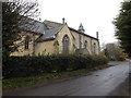
All Saints Parish Church, Wainfleet All Saints
From Haven Side.
Image: © Richard Hoare
Taken: 15 Nov 2014
0.08 miles

