IMAGES TAKEN NEAR TO
Park Avenue, SPILSBY, PE23 5LY
Introduction
This page details the photographs taken nearby to Park Avenue, PE23 5LY by members of the Geograph project.
The Geograph project started in 2005 with the aim of publishing, organising and preserving representative images for every square kilometre of Great Britain, Ireland and the Isle of Man.

There are currently over 7.5m images from over14,400 individuals and you can help contribute to the project by visiting https://www.geograph.org.uk
Image Map
Images are licensed for reuse under creativecommons.org/licenses/by-sa/2.0
Notes
- Clicking on the map will re-center to the selected point.
- The higher the marker number, the further away the image location is from the centre of the postcode.
Image Listing (47 Images Found)
Images are licensed for reuse under creativecommons.org/licenses/by-sa/2.0
Image
Details
Distance
2
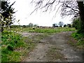
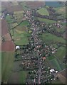
Main Road, Hundleby
Land at the former Gables Hospital where planning permission has been given to erect 1 no. block of 6 no. 3 storey houses, 1 no. block of 5 no. 3 storey houses each with an integral single garage, 1 no. block of 5 no. 2 storey houses, 3 no. blocks of 3 no. 2 storey houses, 1 no. pair of semi-detached 2 storey houses, 1 no. detached 3 storey house with a detached double garage, 2 no. detached 2 storey houses each with a detached double garage, 5 no. detached 2 storey houses each with an integral double garage (35 dwellings in total), construction of a new access road, vehicular accesses and pedestrian accesses, provision of parking areas, on the site of existing hospital buildings which have already been demolished, existing ambulance station to be demolished.
Image: © Dave Hitchborne
Taken: 29 Apr 2008
0.06 miles
3
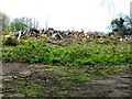
Main Road, Hundleby
A pile of rubble, all that remains of The Gables Hospital. Planning permission has been given for several houses.
1 no. block of 6 no. 3 storey houses, 1 no. block of 5 no. 3 storey houses each with an integral single garage, 1 no. block of 5 no. 2 storey houses, 3 no. blocks of 3 no. 2 storey houses, 1 no. pair of semi-detached 2 storey houses, 1 no. detached 3 storey house with a detached double garage, 2 no. detached 2 storey houses each with a detached double garage, 5 no. detached 2 storey houses each with an integral double garage (35 dwellings in total), construction of a new access road, vehicular accesses and pedestrian accesses, provision of parking areas, on the site of existing hospital buildings which have already been demolished, existing ambulance station to be demolished.
Image: © Dave Hitchborne
Taken: 29 Apr 2008
0.07 miles
4
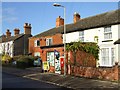
Post Office, Hundleby
The Post Office is earmarked for closure. The Gables Hospital once stood opposite and now is a pile of rubble.
http://www.google.co.uk/search?q=The+Gables%2C+Hundleby&sourceid=navclient-ff&ie=UTF-8&rlz=1B3GGGL_enGB256GB256
Image: © Dave Hitchborne
Taken: 3 Dec 2007
0.09 miles