
IMAGES TAKEN NEAR TO
Drainside, BOSTON, PE22 8JA
Introduction
This page details the photographs taken nearby to Drainside, PE22 8JA by members of the Geograph project.
The Geograph project started in 2005 with the aim of publishing, organising and preserving representative images for every square kilometre of Great Britain, Ireland and the Isle of Man.

There are currently over 7.5m images from over14,400 individuals and you can help contribute to the project by visiting https://www.geograph.org.uk
Image Map
Images are licensed for reuse under creativecommons.org/licenses/by-sa/2.0
Notes
- Clicking on the map will re-center to the selected point.
- The higher the marker number, the further away the image location is from the centre of the postcode.
Image Listing (28 Images Found)
Images are licensed for reuse under creativecommons.org/licenses/by-sa/2.0
Image
Details
Distance
1
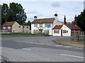
The Wheatsheaf, Eastville
The pub stands on the corner of Spilsby Road and Fodderdyke Bank.
Image: © Dave Hitchborne
Taken: 26 May 2007
0.04 miles
2

Fodder Dyke
Looking west from Eastville, New Leake
Image: © Richard Croft
Taken: 21 May 2008
0.05 miles
3

Approaching level-crossing near former East Ville station
View eastward on the Stickney - Wainfleet road, across the remaining stretch (Boston, to right - Skegness, to left) section of the former ex-GNR Peterborough - Spalding - Boston - Firsby/Skegness - Grimsby main line, most of which was closed from 5/10/70. East Ville (two words) station had been off to the right and was closed to passengers from 11/9/61, to goods from 15/6/64.
Image: © Ben Brooksbank
Taken: 17 Jun 1992
0.06 miles
4

Spilsby Road, New Leake: former pub
You can just make out the empty frame where the name once hung, on pole left of the building.
Image: © Chris
Taken: 7 Jun 2015
0.06 miles
5
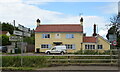
The former Wheatsheaf Public house, Eastville
Image: © JThomas
Taken: 11 Jul 2020
0.06 miles
6

The Wheatsheaf
Pub at Eastville, New Leake
Image: © Richard Croft
Taken: 21 May 2008
0.06 miles
7

Crossroads at Eastville
The Wheatsheaf Inn is on the left
Image: © John Firth
Taken: 13 Jun 2013
0.08 miles
8
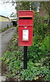
Elizabeth II postbox on Spilsby Road, Eastville
Postbox No. PE22 119.
See Image] for context.
Image: © JThomas
Taken: 11 Jul 2020
0.08 miles
9
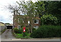
House on Spilsby Road, Eastville
Showing position of Postbox No. PE22 119.
See Image] for postbox.
Image: © JThomas
Taken: 11 Jul 2020
0.08 miles
10

Approaching Eastville along Fodder Dike Bank
Image: © J.Hannan-Briggs
Taken: 4 Dec 2011
0.12 miles