
IMAGES TAKEN NEAR TO
Charter Close, BOSTON, PE21 9PD
Introduction
This page details the photographs taken nearby to Charter Close, PE21 9PD by members of the Geograph project.
The Geograph project started in 2005 with the aim of publishing, organising and preserving representative images for every square kilometre of Great Britain, Ireland and the Isle of Man.

There are currently over 7.5m images from over14,400 individuals and you can help contribute to the project by visiting https://www.geograph.org.uk
Image Map
Images are licensed for reuse under creativecommons.org/licenses/by-sa/2.0
Notes
- Clicking on the map will re-center to the selected point.
- The higher the marker number, the further away the image location is from the centre of the postcode.
Image Listing (16 Images Found)
Images are licensed for reuse under creativecommons.org/licenses/by-sa/2.0
Image
Details
Distance


5

National Cycle Route 1 approaching Boston
Heading south east on the former Lincoln to Boston Railway.
The line from Lincoln to Boston was known as the Witham loop as it followed the course of the River Witham.
Image: © JThomas
Taken: 18 Oct 2014
0.19 miles

7
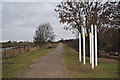
Ex Lincolnshire Loop Line
The signals and long straight path the only signs of a once busy mainline.
Image: © Ashley Dace
Taken: 15 Jan 2011
0.20 miles
8
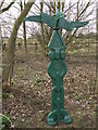
Milepost on route 1, National Cycle Network
NCN sign near the Country park on the railway trail just out of Boston.
Image: © Michael Trolove
Taken: 16 Mar 2009
0.21 miles
9

New housing, Riverside, Boston
Chestnut Homes development. The nearest block of flats is Somerton House http://www.chestnuthomes.co.uk/find-a-new-home/riverside/
Image: © Tim Heaton
Taken: 1 Jul 2016
0.21 miles
10

Witham Bank East, Boston
'Antigua' tied up at its seasonal moorings.
Image: © Dave Hitchborne
Taken: 15 Apr 2008
0.21 miles