
IMAGES TAKEN NEAR TO
Witham Bank West, BOSTON, PE21 8PT
Introduction
This page details the photographs taken nearby to Witham Bank West, PE21 8PT by members of the Geograph project.
The Geograph project started in 2005 with the aim of publishing, organising and preserving representative images for every square kilometre of Great Britain, Ireland and the Isle of Man.

There are currently over 7.5m images from over14,400 individuals and you can help contribute to the project by visiting https://www.geograph.org.uk
Image Map
Images are licensed for reuse under creativecommons.org/licenses/by-sa/2.0
Notes
- Clicking on the map will re-center to the selected point.
- The higher the marker number, the further away the image location is from the centre of the postcode.
Image Listing (48 Images Found)
Images are licensed for reuse under creativecommons.org/licenses/by-sa/2.0
Image
Details
Distance
1

River Witham
The large river and in the distance the landmark called the 'Boston Stump' as a spire was never added.
Image: © Ashley Dace
Taken: 15 Jan 2011
0.05 miles
2

Approaching Boston on National Cycle Route 1
New build flats to the left, the iconic Boston Stump in the distance.
heading east on the former Lincoln to Boston Railway.
The line from Lincoln to Boston was known as the Witham loop as it followed the course of the River Witham.
Image: © JThomas
Taken: 18 Oct 2014
0.06 miles
3

Witham Bank East, Boston
A 'posh' narrow boat.
Image: © Dave Hitchborne
Taken: 15 Apr 2008
0.08 miles
4

Witham Bank East, Boston
The marina. On this river bank and a few hundred upstream, the Lincoln to Boston railway line ran. The line was a favourite with anglers from Sheffield and all stops in between. There was a junction at Kirkstead for the branch to Horncastle.
Image: © Dave Hitchborne
Taken: 15 Apr 2008
0.08 miles
5

Witham Bank East, Boston
This long shot pulls in all the boats, the railway bridge, St Botolph and even the pylons which carry the power cables over the lower part of the River Witham.
Image: © Dave Hitchborne
Taken: 15 Apr 2008
0.09 miles
6
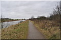
Ex Lincolnshire Loop Line
This is just north of Boston looking towards Antons Gowt lock.
Image: © Ashley Dace
Taken: 15 Jan 2011
0.09 miles
7

New housing, Riverside, Boston
Chestnut Homes development. The nearest block of flats is Somerton House http://www.chestnuthomes.co.uk/find-a-new-home/riverside/
Image: © Tim Heaton
Taken: 1 Jul 2016
0.10 miles
8

Witham Bank East, Boston
The 'Boston Belle', a public and private charter cruiser, for river and sea trips.
Image: © Dave Hitchborne
Taken: 15 Apr 2008
0.10 miles
9

Witham Bank East, Boston
'Antigua' tied up at its seasonal moorings.
Image: © Dave Hitchborne
Taken: 15 Apr 2008
0.10 miles
10

The landing stage and finish line at Boston Rowing club on Marathon day
Image: © Clive Nicholson
Taken: 20 Sep 2015
0.11 miles