
IMAGES TAKEN NEAR TO
PE21 7SN
Introduction
This page details the photographs taken nearby to PE21 7SN by members of the Geograph project.
The Geograph project started in 2005 with the aim of publishing, organising and preserving representative images for every square kilometre of Great Britain, Ireland and the Isle of Man.

There are currently over 7.5m images from over14,400 individuals and you can help contribute to the project by visiting https://www.geograph.org.uk
Image Map
Images are licensed for reuse under creativecommons.org/licenses/by-sa/2.0
Notes
- Clicking on the map will re-center to the selected point.
- The higher the marker number, the further away the image location is from the centre of the postcode.
Image Listing (63 Images Found)
Images are licensed for reuse under creativecommons.org/licenses/by-sa/2.0
Image
Details
Distance
1

The Boston Stump
The tower of St Botolph's Church is 271 feet high.
Image: © Mat Fascione
Taken: 13 Jul 2013
0.06 miles
2

Macmillan Way footpath along The Haven
Image: © Mat Fascione
Taken: 13 Jul 2013
0.09 miles
3

Gantry along The Haven (River Witham)
On the opposite bank is St Nicholas Church in Skirbeck.
Image: © Mat Fascione
Taken: 13 Jul 2013
0.10 miles
4

Two churches
From the sea wall on the south side of the River Haven south-east of Boston. Two churches can be seen. To the right, Skirbeck Church on the north side of the Haven. To the left below the pylons, Boston Stump (St Botolphs, Boston) in the centre of Boston; a landmark for miles around. In the foreground the flood plain of the River Haven can be seen, contained by the sea bank to the left.
Image: © Graham Horn
Taken: 20 Apr 2007
0.11 miles
5

River Haven
As the River Haven heads towards the Wash, it becomes more rural, leaving the Post of Boston behind. The sea wall on both sides is a few metres above the river, sometimes close to its bank and sometimes drifting inland. The Macmillan Way (290-mile coast to coast route from Lincolnshire to Dorset) follows this bank for several miles.
Image: © Graham Horn
Taken: 20 Apr 2007
0.11 miles
6
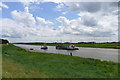
The Vicky Ellen (left) passing the Mary Angus, the Haven, Boston
The Mary Angus is a 'hopper dredger'
Image: © Tim Heaton
Taken: 1 Jul 2016
0.12 miles
7

The Haven, Boston (3)
Looking along the short tidal River Haven which connects the Wash (behind) to the docks and the River Witham (ahead).
The ship making its way into the docks is Fast Sam, a 3,200-tonne cargo ship flying the Belgian flag. Commercial traffic is piloted from the Wash as only a narrow stretch of river is navigable and only at high tide.
Image: © Stephen Richards
Taken: 18 Dec 2011
0.12 miles
8

Pylon Forest
A number of electricity supply routes converge here on the south side of the River Haven, creating a forest of pylons. The horses seem happy to graze beneath them.
Image: © Graham Horn
Taken: 20 Apr 2007
0.12 miles
9

High and mighty
Two (and a half) of the many tall pylons overlooking the Port of Boston.
Image: © Ian Paterson
Taken: 12 Sep 2009
0.12 miles
