
IMAGES TAKEN NEAR TO
Heron Way, BOSTON, PE21 7SH
Introduction
This page details the photographs taken nearby to Heron Way, PE21 7SH by members of the Geograph project.
The Geograph project started in 2005 with the aim of publishing, organising and preserving representative images for every square kilometre of Great Britain, Ireland and the Isle of Man.

There are currently over 7.5m images from over14,400 individuals and you can help contribute to the project by visiting https://www.geograph.org.uk
Image Map
Images are licensed for reuse under creativecommons.org/licenses/by-sa/2.0
Notes
- Clicking on the map will re-center to the selected point.
- The higher the marker number, the further away the image location is from the centre of the postcode.
Image Listing (11 Images Found)
Images are licensed for reuse under creativecommons.org/licenses/by-sa/2.0
Image
Details
Distance
1

New housing development, Wyberton Farmstead
Image: © Jonathan Thacker
Taken: 25 Mar 2022
0.10 miles
2

Wyberton Low Road
Drain beside Wyberton Low Road, seen from Stump Cross
Image: © Richard Croft
Taken: 8 Aug 2009
0.16 miles
3

Slippery Gowt Lane
Drain and Slippery Gowt Lane from Stump Cross
Image: © Richard Croft
Taken: 8 Aug 2009
0.16 miles
4

Del Monte Distribution Centre, Slippery Gowt Lane, Boston
A Del Monte distribution hub. A "gowt" is a drainage passage that lets water flow out to sea at low tide. A number of "gowts" can be found in the Boston Area
Image: © Michael Trolove
Taken: 16 Mar 2009
0.16 miles
6

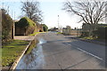
Traffic management, Slippery Gowt Lane
Bollards set in the junction to prevent heavy traffic using unsuitable roads.
Image: © Michael Trolove
Taken: 16 Mar 2009
0.17 miles
7

Slippery Gowt Lane
Slippery Gowt Lane continues beyond the junction, Marsh Lane goes off to the right.
Image: © Antony Dixon
Taken: 4 Sep 2013
0.17 miles
8

New housing development on Wyberton Low Road, Wyberton
Image: © JThomas
Taken: 11 Aug 2020
0.18 miles
9

Drain beside Wyberton Low Road, Wyberton
National Cycle Route 1.
Image: © JThomas
Taken: 11 Aug 2020
0.19 miles
10

Industrial tank
Abandoned industrial site on Marsh Lane
Image: © Michael Trolove
Taken: 16 Mar 2009
0.22 miles