
IMAGES TAKEN NEAR TO
Riverside Quay, BOSTON, PE21 6BT
Introduction
This page details the photographs taken nearby to Riverside Quay, PE21 6BT by members of the Geograph project.
The Geograph project started in 2005 with the aim of publishing, organising and preserving representative images for every square kilometre of Great Britain, Ireland and the Isle of Man.

There are currently over 7.5m images from over14,400 individuals and you can help contribute to the project by visiting https://www.geograph.org.uk
Image Map
Images are licensed for reuse under creativecommons.org/licenses/by-sa/2.0
Notes
- Clicking on the map will re-center to the selected point.
- The higher the marker number, the further away the image location is from the centre of the postcode.
Image Listing (194 Images Found)
Images are licensed for reuse under creativecommons.org/licenses/by-sa/2.0
Image
Details
Distance

2
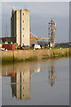
View across The Haven
Grain silo and elevator, reflected in still water as the tide was rising.
Image: © Alan Murray-Rust
Taken: 19 Nov 2014
0.01 miles
3

Red Cans
Red buoys parked on the quayside at the Port of Boston.
Image: © Ian Paterson
Taken: 12 Sep 2009
0.02 miles
4

'Ten Buoys', Boston
Buoys lined up on Riverside Quay.
Image: © Dave Hitchborne
Taken: 18 Aug 2003
0.03 miles
5

Pining for the sea
Four conical buoys lined up on the sides of the Port of Boston.
Image: © Ian Paterson
Taken: 12 Sep 2009
0.03 miles
6

Port of Boston
Grain storage facilities at the Port of Boston
Image: © Richard Croft
Taken: 3 Feb 2009
0.03 miles
7

Mary Angus, Port of Boston dredger
Licensed to remove 94,900 tonnes of material a year from the Boston port. Not sure what Dragline is on board.
Image: © Michael Trolove
Taken: 16 Mar 2009
0.04 miles
8

Panorama of Riverside Quay, Boston - 1 of 2
Looking from across the River Witham near London Road.
Image: © Dave Hitchborne
Taken: 18 Aug 2003
0.04 miles
10
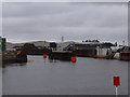
The Boston Barrier - channel open 1st June 2020
Taken a few days after the official opening of the channel and with lots of work still to do, the Boston Barrier Project is taking shape. Reducing flood risk and maintaining water levels in the tidal area is the aim. The barrier is an arced gate which can be raised and lowered to stem the tide.
Here are two earlier shots of the general area : Image & Image
Here is a closer view of the side of the barrier : Image
If you Twitter or Facebook, here is more information including a neat time-lapse :
https://twitter.com/BostonBarrierEA/status/1267853827778150400?ref_src=twsrc%5Egoogle%7Ctwcamp%5Eserp%7Ctwgr%5Etweet
https://www.facebook.com/BostonBarrier/
Image: © Ian Paterson
Taken: 3 Jun 2020
0.05 miles