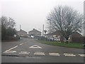
IMAGES TAKEN NEAR TO
Mulberry Court, BOSTON, PE20 3LN
Introduction
This page details the photographs taken nearby to Mulberry Court, PE20 3LN by members of the Geograph project.
The Geograph project started in 2005 with the aim of publishing, organising and preserving representative images for every square kilometre of Great Britain, Ireland and the Isle of Man.

There are currently over 7.5m images from over14,400 individuals and you can help contribute to the project by visiting https://www.geograph.org.uk
Image Map
Images are licensed for reuse under creativecommons.org/licenses/by-sa/2.0
Notes
- Clicking on the map will re-center to the selected point.
- The higher the marker number, the further away the image location is from the centre of the postcode.
Image Listing (69 Images Found)
Images are licensed for reuse under creativecommons.org/licenses/by-sa/2.0
Image
Details
Distance
1
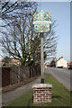
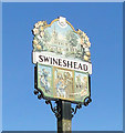
Millennium sign
Swineshead village sign approaching from the south
Image: © Richard Croft
Taken: 5 Mar 2010
0.10 miles
2
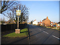
Millennium village sign in South Street, Swineshead, Lincs
The sign is located near to the Stump Cross at the southern end of the village; view NNW towards the village centre.
Image: © Rodney Burton
Taken: 23 Dec 2007
0.10 miles
3
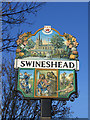
Detail of village sign, Swineshead, Lincs
The arms bear a boar's head, although the swine in the village name is derived from a silted waterway called the Swin and not from associations with the animal. The motto 'per utilitate' may be translated as 'through service'. The upper panel is of the Market Place with the War Memorial, gardens, stocks and a 14th century cross base, and St Mary's parish church behind. The lower panel shows, from the left, the Swineshead Silver Band, founded in 1886 as a brass band; King John, who took lodgings and was supposedly poisoned by a monk in Swineshead's Cistercian Abbey in October 1216 after losing his treasure in The Wash; and a representation of the rich agriculture of the area.
Image: © Rodney Burton
Taken: 23 Dec 2007
0.10 miles
4
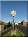
Swineshead village sign
http://www.geograph.org.uk/photo/5604384
Image: © Adrian S Pye
Taken: 19 Nov 2017
0.11 miles
5
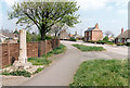
Stump Cross, Swineshead, Lincs
The shaft of a roadside cross, a Scheduled Ancient Monument; view N along South Street from the junction with Stump Cross Lane.
Image: © Rodney Burton
Taken: Unknown
0.11 miles
6
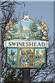
Millennium sign detail
Scenes from Swineshead on the Millennium village sign http://www.geograph.org.uk/photo/1741603 including the lower middle panel depicting a malevolent monk of Swineshead Abbey poisoning King John in 1216 after his disastrous crossing of The Wash ... he died at Newark a few days later.
Image: © Richard Croft
Taken: 5 Mar 2010
0.11 miles
9
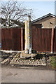
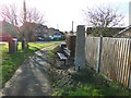
Stump Cross
Base and lower shaft of a 14th century wayside cross known locally as "Stump Cross" approaching Swineshead from the south
Image: © Richard Croft
Taken: 5 Mar 2010
0.12 miles