
IMAGES TAKEN NEAR TO
St. Neots Road, ST. NEOTS, PE19 7AL
Introduction
This page details the photographs taken nearby to St. Neots Road, PE19 7AL by members of the Geograph project.
The Geograph project started in 2005 with the aim of publishing, organising and preserving representative images for every square kilometre of Great Britain, Ireland and the Isle of Man.

There are currently over 7.5m images from over14,400 individuals and you can help contribute to the project by visiting https://www.geograph.org.uk
Image Map
Images are licensed for reuse under creativecommons.org/licenses/by-sa/2.0
Notes
- Clicking on the map will re-center to the selected point.
- The higher the marker number, the further away the image location is from the centre of the postcode.
Image Listing (18 Images Found)
Images are licensed for reuse under creativecommons.org/licenses/by-sa/2.0
Image
Details
Distance
1

St Neots Indoor Bowling Club
St Neots Indoor Bowling Club is a bowling club, located on River Road in St Neots. The building is out of the way of main roads, so you may come across it accidentally as I did.
Image: © Matthew Morgan
Taken: 6 Jun 2018
0.07 miles
2
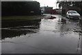
Flood on River Road, St Neots
I had no idea of the road name till I saw the photo at home. Something of a coincidence. These were the worst floods I encountered that day but there were a lot in the area like this.
Image: © David Howard
Taken: 16 Aug 2020
0.12 miles
3

The Old Chequers
I suppose the name means this was once a pub. It is currently available to rent at £1,250 PCM.
The listed building register gives it as C17, timber-framed cottage with windbraces. Colour-washed brick ground floor and plastered 1st floor. Old tile roof. Group II listed, LBS Number: 53322. http://www.heritagegateway.org.uk/Gateway/Results_Single.aspx?uid=53322&resourceID=5
Image: © Keith Edkins
Taken: 29 Jan 2009
0.17 miles
4

Old stonemasons' cottages - plaque
Detail on Image
Image: © Keith Edkins
Taken: 29 Jan 2009
0.19 miles
5

Old stonemasons' cottages
Eighteenth century - see Image
The listed buildings register puts them as later C17 or earlier C18. Timber framed
with whitened plaster and brick. Tiled roof. Grade II listed, LBS Number: 53323. http://www.heritagegateway.org.uk/Gateway/Results_Single.aspx?uid=53323&resourceID=5
Image: © Keith Edkins
Taken: 29 Jan 2009
0.19 miles
6

Alfred Rowlett's cottage - plaque
Detail on Image
Image: © Keith Edkins
Taken: 29 Jan 2009
0.20 miles
7

Alfred Rowlett's cottage
What do you mean, "Who?" He's famous, is our Alfred! He discovered Bunyan's anvil, so he did. See Image
The building is a later C17 or earlier C18 timber-framed cottage. Grade II listed, LBS Number: 53324. http://www.heritagegateway.org.uk/Gateway/Results_Single.aspx?uid=53324&resourceID=5
Image: © Keith Edkins
Taken: 29 Jan 2009
0.20 miles
8

Crosshall Road, St Neots
Looking towards St Neots Road
Image: © David Howard
Taken: 22 Aug 2019
0.20 miles
9

Flooded play park, Riverside Park, St Neot's
Image: © Ruth Sharville
Taken: 9 Feb 2014
0.21 miles
10

St. Neots skatepark
Skatepark located within the town of St. Neots (Eaton Socon).
Image: © Matthew Morgan
Taken: 6 Jun 2018
0.22 miles