
IMAGES TAKEN NEAR TO
Marbled White Court, ST. NEOTS, PE19 6SJ
Introduction
This page details the photographs taken nearby to Marbled White Court, PE19 6SJ by members of the Geograph project.
The Geograph project started in 2005 with the aim of publishing, organising and preserving representative images for every square kilometre of Great Britain, Ireland and the Isle of Man.

There are currently over 7.5m images from over14,400 individuals and you can help contribute to the project by visiting https://www.geograph.org.uk
Image Map
Images are licensed for reuse under creativecommons.org/licenses/by-sa/2.0
Notes
- Clicking on the map will re-center to the selected point.
- The higher the marker number, the further away the image location is from the centre of the postcode.
Image Listing (31 Images Found)
Images are licensed for reuse under creativecommons.org/licenses/by-sa/2.0
Image
Details
Distance
1

Papermill Lock development continuing
The paper mill itself was on the island to the left, which has already been built on.
Image: © Hugh Venables
Taken: 15 May 2016
0.02 miles
2
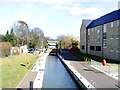
St Neots lock, Little Paxton
This is Lock 9 on the River Great Ouse. The mainstream of the river flows on the far side of The Island - which is the land on which the flats seen here have been built.
Image: © David Kemp
Taken: 27 Feb 2008
0.02 miles
3
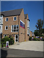
Papermill Lock sales office
With construction continuing of one and two bedroom flats.
Image: © Hugh Venables
Taken: 15 May 2016
0.03 miles
4

Papermill Lock development continuing
New one and two bedroom flats by the Great Ouse. The paper mill itself was on the island in the river and the site has already been built on Image
Image: © Hugh Venables
Taken: 15 May 2016
0.03 miles
6
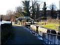
Lock No. 9
See http://www.geograph.org.uk/photo/1260326 for a 2009 picture. The building on the right with scaffolding on it was not present then.
Image: © Bikeboy
Taken: 22 Dec 2013
0.04 miles
7

St Neots Lock No.9
St Neots Lock No 9 is on the River Great Ouse (Canalized Section); between St Neots (1.25 miles to the south) and Great Paxton (1.75 miles to the northeast)
Image: © Eirian Evans
Taken: 8 Apr 2009
0.04 miles
8

Great River Ouse, St Neots
On the right is Lock no. 9 and footbridge over the canalized section of the river.
Image: © Eirian Evans
Taken: 8 Apr 2009
0.04 miles
9
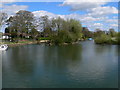
The Great River Ouse, St Neots
Taken from the Mill Lane bridge. The Ouse Valley way runs along the bank on the left.
Image: © Eirian Evans
Taken: 8 Apr 2009
0.05 miles
10

St Neots Housing development
New housing development near the St Neots Lock on the canalized section of the Great River Ouse.
Image: © Eirian Evans
Taken: 8 Apr 2009
0.06 miles