
IMAGES TAKEN NEAR TO
Gordon Close, ST. NEOTS, PE19 6PF
Introduction
This page details the photographs taken nearby to Gordon Close, PE19 6PF by members of the Geograph project.
The Geograph project started in 2005 with the aim of publishing, organising and preserving representative images for every square kilometre of Great Britain, Ireland and the Isle of Man.

There are currently over 7.5m images from over14,400 individuals and you can help contribute to the project by visiting https://www.geograph.org.uk
Image Map
Images are licensed for reuse under creativecommons.org/licenses/by-sa/2.0
Notes
- Clicking on the map will re-center to the selected point.
- The higher the marker number, the further away the image location is from the centre of the postcode.
Image Listing (23 Images Found)
Images are licensed for reuse under creativecommons.org/licenses/by-sa/2.0
Image
Details
Distance
1

Hayling Lake, Paxton Pits
With areas of water soldier, an aquatic plant that has recently attracted a small population of Norfolk Hawker dragonflies to colonise the lake.
Image: © Hugh Venables
Taken: 15 May 2016
0.12 miles


4
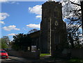
St James' Church, Little Paxton
The church is not mentioned in the Domesday Survey (1086), but a stone church was standing here towards the end of the 12th century, of which considerable parts of the chancel walls remain, together with the reset south door of the church. The church's north wall is said to have been knocked down in the Civil Wars, but was rebuilt or much modified in 1849 when the church was completely restored.
Image: © Eirian Evans
Taken: 8 Apr 2009
0.20 miles
5
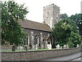
St James's church, Little Paxton
Brown cobble church with 12th century nave and chancel.
Image: © Simon Mortimer
Taken: 12 Jun 2007
0.20 miles

7
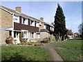
Hayling Walk, Little Paxton
These houses are just a few yards to the left of the River Great Ouse and date from a time when no one worried too much about building on floodplains. The tarmacked path is the Ouse Valley Way.
Image: © David Kemp
Taken: 27 Feb 2008
0.20 miles
8
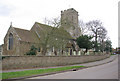
Little Paxton Church
St James's Church on High Street dates in part from the 12th century, although it has been extensively rebuilt and restored. The tower was built c1400.
Image: © Stephen McKay
Taken: 14 Mar 2009
0.21 miles
9
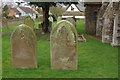
Little Paxton churchyard
These gravestones stand outside St James's Church on High Street.
Image: © Stephen McKay
Taken: 14 Mar 2009
0.21 miles
10
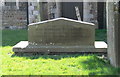
Tomb at St James' Church, Little Paxton
The tombstone of John Buonarotti Papworth, architect and artist, in the churchyard at Little Paxton. According to the stone he was architect to the king of Wurtemburg.
Image: © Eirian Evans
Taken: 8 Apr 2009
0.22 miles