
IMAGES TAKEN NEAR TO
Top Birches, ST. NEOTS, PE19 6BD
Introduction
This page details the photographs taken nearby to Top Birches, PE19 6BD by members of the Geograph project.
The Geograph project started in 2005 with the aim of publishing, organising and preserving representative images for every square kilometre of Great Britain, Ireland and the Isle of Man.

There are currently over 7.5m images from over14,400 individuals and you can help contribute to the project by visiting https://www.geograph.org.uk
Image Map
Images are licensed for reuse under creativecommons.org/licenses/by-sa/2.0
Notes
- Clicking on the map will re-center to the selected point.
- The higher the marker number, the further away the image location is from the centre of the postcode.
Image Listing (46 Images Found)
Images are licensed for reuse under creativecommons.org/licenses/by-sa/2.0
Image
Details
Distance
1

New housing, St Neots
Part of a large new development east of the railway.
Image: © Hugh Venables
Taken: 1 Jul 2012
0.03 miles
2

St Neots FC football ground
Don't be confused. This is not the old football ground on the B1428 Cambridge Road but a brand new ground a few hundred metres to the north in Kester Way.
Image: © Mike W Hallett
Taken: 4 Sep 2009
0.11 miles
3

New housing, St Neots
Part of a large ongoing expansion of the town to the east of the railway. The land was previously agricultural.
Image: © Hugh Venables
Taken: 1 Jul 2012
0.16 miles
4

New housing, St Neots
Part of a large new development to the east of the railway on what was Love's Farm.
Image: © Hugh Venables
Taken: 1 Jul 2012
0.17 miles
5

Footpath through new housing
Completed housing on the left, houses under construction on the right.
Image: © Hugh Venables
Taken: 1 Jul 2012
0.19 miles
6

Hawkesden Road, St Neots
At its junction with Longsands Road.
Image: © Richard Vince
Taken: 14 Jan 2023
0.19 miles
7

Footpath through new housing
Part of a new development on the edge of St Neots to the east of the railway.
Image: © Hugh Venables
Taken: 1 Jul 2012
0.19 miles
8
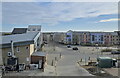
Like a new town
The Loves Farm development next to St Neot's station is essentially a new small town, dating from the first decade of the 21st century.
Image: © Bob Harvey
Taken: 7 Dec 2022
0.20 miles
9

Supermarket at the housing estate
Part of the new Loves Farm development is this retail block, with a supermarket and a fast food outlet. There is a pharmacy here too.
Image: © Bob Harvey
Taken: 7 Dec 2022
0.21 miles
10

Longsands Road, St Neots
Off Hawkesden Road.
Image: © Richard Vince
Taken: 14 Jan 2023
0.21 miles