
IMAGES TAKEN NEAR TO
Taylors Lane, ST. NEOTS, PE19 5UP
Introduction
This page details the photographs taken nearby to Taylors Lane, PE19 5UP by members of the Geograph project.
The Geograph project started in 2005 with the aim of publishing, organising and preserving representative images for every square kilometre of Great Britain, Ireland and the Isle of Man.

There are currently over 7.5m images from over14,400 individuals and you can help contribute to the project by visiting https://www.geograph.org.uk
Image Map
Images are licensed for reuse under creativecommons.org/licenses/by-sa/2.0
Notes
- Clicking on the map will re-center to the selected point.
- The higher the marker number, the further away the image location is from the centre of the postcode.
Image Listing (90 Images Found)
Images are licensed for reuse under creativecommons.org/licenses/by-sa/2.0
Image
Details
Distance
1

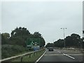
High Street Hardwick at the junction of the A1
Image: © David Howard
Taken: 13 Jan 2018
0.09 miles
4
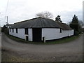
The Corner Shed
This 90° bend in Hardwick sits right on the grid line.
Don't come this way with an articulated lorry
Image: © Michael Trolove
Taken: 28 Feb 2009
0.12 miles
5

Buckden: entrance to the yard of a former coaching inn
This house, on what was originally The Great North Road, was once The Spread Eagle Inn. For its Grade II listing, see http://www.britishlistedbuildings.co.uk/en-54312-spread-eagle-public-house-buckden-cambrid#.VWX3VSiwHZY .
Image: © John Sutton
Taken: 27 May 2015
0.12 miles
6

Buckden: the former Spread Eagle Inn
An eighteenth-century coaching inn on Buckden High Street, originally The Great North Road. For its Grade II listing, see http://www.britishlistedbuildings.co.uk/en-54312-spread-eagle-public-house-buckden-cambrid#.VWX3VSiwHZY .
Image: © John Sutton
Taken: 27 May 2015
0.13 miles
7

Underpass beneath the A1. Buckden
Provides a safe link to Hardwick for cyclists and pedestrians.
Image: © JThomas
Taken: 4 Jun 2015
0.14 miles
8

Buckden High Street
This was once The Great North Road, which, now the A1, bypasses Buckden. Many of the houses are Grade II listed.
Image: © John Sutton
Taken: 27 May 2015
0.15 miles
10

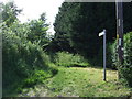
Equine Subway
With the A1 cutting off parts of Buckden and the small village of Hardwick. Two subways have long been installed for pedestrians,cyclists and apparently, horses. This is the western side of the Buckden/Hardwick subway.
Image: © Michael Trolove
Taken: 28 Feb 2009
0.15 miles