IMAGES TAKEN NEAR TO
PE17 4PU
Introduction
This page details the photographs taken nearby to PE17 4PU by members of the Geograph project.
The Geograph project started in 2005 with the aim of publishing, organising and preserving representative images for every square kilometre of Great Britain, Ireland and the Isle of Man.

There are currently over 7.5m images from over14,400 individuals and you can help contribute to the project by visiting https://www.geograph.org.uk
Image Map
Images are licensed for reuse under creativecommons.org/licenses/by-sa/2.0
Notes
- Clicking on the map will re-center to the selected point.
- The higher the marker number, the further away the image location is from the centre of the postcode.
Image Listing (180 Images Found)
Images are licensed for reuse under creativecommons.org/licenses/by-sa/2.0
Image
Details
Distance
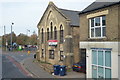
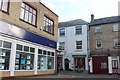
2
Houses beside Warner?s Park, St Ives, Hunts
Image: © Michael Behrend
Taken: 5 Oct 2014
0.08 miles
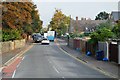
5
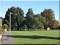
Path in Warner?s Park, St Ives, Hunts
This path runs along the front of the houses shown in Image
Image: © Michael Behrend
Taken: 5 Oct 2014
0.11 miles
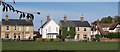
9
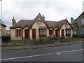
Pilgrims Rest
Church houses for the needy.
Image: © Michael Trolove
Taken: 28 Mar 2009
0.13 miles