
IMAGES TAKEN NEAR TO
Langwood Fen Drove, CHATTERIS, PE16 6XD
Introduction
This page details the photographs taken nearby to Langwood Fen Drove, PE16 6XD by members of the Geograph project.
The Geograph project started in 2005 with the aim of publishing, organising and preserving representative images for every square kilometre of Great Britain, Ireland and the Isle of Man.

There are currently over 7.5m images from over14,400 individuals and you can help contribute to the project by visiting https://www.geograph.org.uk
Image Map
Images are licensed for reuse under creativecommons.org/licenses/by-sa/2.0
Notes
- Clicking on the map will re-center to the selected point.
- The higher the marker number, the further away the image location is from the centre of the postcode.
Image Listing (4 Images Found)
Images are licensed for reuse under creativecommons.org/licenses/by-sa/2.0
Image
Details
Distance
1
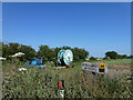
Kings Barn to the left
Situated at the end of Langwood Fen Drove, Horseway in very quiet fenland countryside I was surprised to come across this AA sign. It leads to a highly rated B & B in a working farm, see http://www.kingsbarn-bandb.co.uk/#
Image: © Richard Humphrey
Taken: 6 Jul 2013
0.10 miles
2

Spraying crops on Langwood Fen
The newly germinated crop is getting sprayed.
Image: © Alison Rawson
Taken: 5 Oct 2007
0.12 miles
3

Track to Langwood South Farm
The leaning telegraph poles are a regular feature of the Fenland - the drying and shrinking of the peat has led to uneven settlement in the soil.
Image: © Alison Rawson
Taken: 5 Oct 2007
0.12 miles
4

Field, Langwood Fen
Off Langwood Fen Drove.
Image: © JThomas
Taken: 12 Aug 2017
0.25 miles