
IMAGES TAKEN NEAR TO
Doddington Road, MARCH, PE15 0RA
Introduction
This page details the photographs taken nearby to Doddington Road, PE15 0RA by members of the Geograph project.
The Geograph project started in 2005 with the aim of publishing, organising and preserving representative images for every square kilometre of Great Britain, Ireland and the Isle of Man.

There are currently over 7.5m images from over14,400 individuals and you can help contribute to the project by visiting https://www.geograph.org.uk
Image Map
Images are licensed for reuse under creativecommons.org/licenses/by-sa/2.0
Notes
- Clicking on the map will re-center to the selected point.
- The higher the marker number, the further away the image location is from the centre of the postcode.
Image Listing (35 Images Found)
Images are licensed for reuse under creativecommons.org/licenses/by-sa/2.0
Image
Details
Distance
1

House on March Road
Opposite the junction with Chapel Lane.
Image: © Keith Edkins
Taken: 24 Oct 2007
0.09 miles
2

Wimblington War Memorial Playing Field
This playing field is dedicated to the memory of the dead of the two World Wars from the parish of Wimblington https://www.iwm.org.uk/memorials/item/memorial/56437 . It includes a football pitch and a children's play area https://hayfenland.co.uk/activities/wimblington-war-memorial-playing-field/ . A ninja trail opened the month after this photograph was taken https://www.cambstimes.co.uk/news/24275292.wimblington-ninja-trail-opens-war-memorial-playing-field/ .
Image: © HelenK
Taken: 30 Mar 2024
0.10 miles

4

Highland cattle in Wimblington, Cambridgeshire
Image: © Richard Humphrey
Taken: 13 Dec 2012
0.17 miles
5
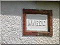
NWRDC plaque on council houses
Detail on Image North Witchford Rural District Council was set up in 1894 and became part of Fenland District in 1974.
Image: © Keith Edkins
Taken: 8 Jul 2011
0.17 miles
6
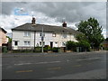
NWRDC Council Houses, March Road
One on the groups of 4 houses built by the North Witchford Rural District Council (abolished in 1974). See ...
Image: © Keith Edkins
Taken: 8 Jul 2011
0.17 miles
7
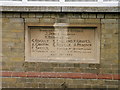
Parish Hall foundation stone
On the front wall of Image
Image: © Keith Edkins
Taken: 8 Jul 2011
0.21 miles
8
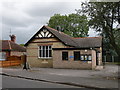
Wimblington Parish Hall
Bearing date 1905, see Image
Image: © Keith Edkins
Taken: 8 Jul 2011
0.21 miles
9

Sisco service station, Doddington Road
Image: © Keith Edkins
Taken: 24 Oct 2007
0.21 miles
10

North House, Church Street
Late C17 or early C18. Local red brick, plain tile roofs. Two storeys, L-plan with symmetrical facade of five 'bays'. Parapet gables with end stacks, plinth and band at first floor; English bond brick coursing.
Grade II* listed, IoE Number: 48506
Image: © Keith Edkins
Taken: 8 Jul 2011
0.22 miles