
IMAGES TAKEN NEAR TO
Whittlesey Road, MARCH, PE15 0EW
Introduction
This page details the photographs taken nearby to Whittlesey Road, PE15 0EW by members of the Geograph project.
The Geograph project started in 2005 with the aim of publishing, organising and preserving representative images for every square kilometre of Great Britain, Ireland and the Isle of Man.

There are currently over 7.5m images from over14,400 individuals and you can help contribute to the project by visiting https://www.geograph.org.uk
Image Map
Images are licensed for reuse under creativecommons.org/licenses/by-sa/2.0
Notes
- Clicking on the map will re-center to the selected point.
- The higher the marker number, the further away the image location is from the centre of the postcode.
Image Listing (14 Images Found)
Images are licensed for reuse under creativecommons.org/licenses/by-sa/2.0
Image
Details
Distance
1

Crossing near Dodd's Farm
The train appeared as we cycled up to the level crossing. This crossing is on the line from Peterborough to March.
Image: © Tony Thomas
Taken: 21 Jun 2007
0.04 miles
2

EMR train running from Peterborough to Norwich
Image: © Tim Heaton
Taken: 20 Jul 2020
0.04 miles
3

Level Crossing at Turves
An opposite view to Image] the level crossing looking towards Peterborough
Image: © Ashley Dace
Taken: 23 Jun 2010
0.09 miles
4

Turves Level Crossing
A view of the Peterborough to Ely railway line towards Ely
Image: © Ashley Dace
Taken: 23 Jun 2010
0.11 miles
5

Cycle Route 63 entering Turves on March Road
Image: © Tim Heaton
Taken: 20 Jul 2020
0.12 miles


8
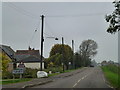
March Road, Turves
A dull and dank day after the fog had cleared a little
Image: © Richard Humphrey
Taken: 24 Oct 2012
0.15 miles
9

Whittlesey Road approaching Prospect House Farm
Image: © Tim Heaton
Taken: 20 Jul 2020
0.18 miles
10

Prospect House Farm, Turves - SOLD
Judging by the wooden props the wall looks a bit unstable?
Image: © Richard Humphrey
Taken: 24 Oct 2012
0.19 miles