
IMAGES TAKEN NEAR TO
School Road, WISBECH, PE14 7QQ
Introduction
This page details the photographs taken nearby to School Road, PE14 7QQ by members of the Geograph project.
The Geograph project started in 2005 with the aim of publishing, organising and preserving representative images for every square kilometre of Great Britain, Ireland and the Isle of Man.

There are currently over 7.5m images from over14,400 individuals and you can help contribute to the project by visiting https://www.geograph.org.uk
Image Map
Images are licensed for reuse under creativecommons.org/licenses/by-sa/2.0
Notes
- Clicking on the map will re-center to the selected point.
- The higher the marker number, the further away the image location is from the centre of the postcode.
Image Listing (31 Images Found)
Images are licensed for reuse under creativecommons.org/licenses/by-sa/2.0
Image
Details
Distance
1

The church of St Edmund in Walpole Highway
The chapel - it is dedicated to St Edmund - has been converted into a private dwelling. It was built by architect JC Buckler in the 1840s - including the very realistic looking Norman features > http://www.geograph.org.uk/photo/1823387 - serving as a chapel of ease to the nearby church of St Peter.
Image: © Evelyn Simak
Taken: 22 Apr 2010
0.02 miles
2

The church of St Edmund in Walpole Highway
The chapel - it is dedicated to St Edmund - has been converted into a private dwelling. It was built by architect JC Buckler in the 1840s - including the very realistic looking Norman features > http://www.geograph.org.uk/photo/1823387 - serving as a chapel of ease to the nearby church of St Peter.
Image: © Evelyn Simak
Taken: 22 Apr 2010
0.02 miles
3

The church of St Edmund in Walpole Highway
The chapel - it is dedicated to St Edmund - has been converted into a private dwelling. It was built by architect JC Buckler in the 1840s - including the very realistic looking Norman features > http://www.geograph.org.uk/photo/1823387 - serving as a chapel of ease to the nearby church of St Peter.
Image: © Evelyn Simak
Taken: 22 Apr 2010
0.02 miles
4

The church of St Edmund in Walpole Highway - pseudo-Norman doorway
The chapel > http://www.geograph.org.uk/photo/1823384 - it is dedicated to St Edmund - has been converted into a private dwelling. It was built by architect JC Buckler in the 1840s - including the very realistic looking Norman features - serving as a chapel of ease to the nearby church of St Peter.
Image: © Evelyn Simak
Taken: 22 Apr 2010
0.02 miles
5

Cottage in School Road, Walpole Highway
Image: © Evelyn Simak
Taken: 22 Apr 2010
0.02 miles
6

Walpole Highway St. Edmunds converted church
The redundant church is now a private dwelling.
Image: © Adrian S Pye
Taken: 22 Apr 2010
0.06 miles
7

Walpole Highway Community Primary School
Image: © Ben Harris
Taken: 30 Aug 2008
0.10 miles
8
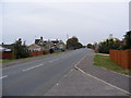
School, Main Road, Walpole Highway
Looking towards West Walton
Image: © Geographer
Taken: 20 Oct 2009
0.12 miles
9

The junction of School Road with Main Road in Walpole Highway
Looking westward.
Image: © Peter Wood
Taken: 8 Nov 2014
0.12 miles
10

Ordnance Survey Flush Bracket S8865
This can be found on the wall of the school at Walpole Highway.
For more detail see : http://www.bench-marks.org.uk/bm19005
Image: © Peter Wood
Taken: 8 Nov 2014
0.12 miles