
IMAGES TAKEN NEAR TO
Walpole Bank, WISBECH, PE14 7JE
Introduction
This page details the photographs taken nearby to Walpole Bank, PE14 7JE by members of the Geograph project.
The Geograph project started in 2005 with the aim of publishing, organising and preserving representative images for every square kilometre of Great Britain, Ireland and the Isle of Man.

There are currently over 7.5m images from over14,400 individuals and you can help contribute to the project by visiting https://www.geograph.org.uk
Image Map
Images are licensed for reuse under creativecommons.org/licenses/by-sa/2.0
Notes
- Clicking on the map will re-center to the selected point.
- The higher the marker number, the further away the image location is from the centre of the postcode.
Image Listing (6 Images Found)
Images are licensed for reuse under creativecommons.org/licenses/by-sa/2.0
Image
Details
Distance
1
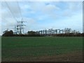
Walpole Electricity sub-station
It seems as if every power line in the country meets at Walpole.
Image: © David Prestidge
Taken: 11 Feb 2007
0.02 miles

3

Expansion work at Walpole electricity substation
Between Wisbech and Sutton Bridge
Image: © Richard Humphrey
Taken: 1 Dec 2010
0.12 miles
4

Pylon country near Walpole substation
It appears that every field has a pylon on it in this part of Norfolk
Image: © Richard Humphrey
Taken: 1 Dec 2010
0.12 miles
5

Entrance to the Walpole electricity sub station
Image: © Adrian S Pye
Taken: 14 May 2019
0.18 miles
6

Sub station for the Lincs offshore windfarm
The Lincs Wind Farm is a 270 MW offshore wind farm 8 kilometres off Skegness on the east coast of England. The total cost of the project is estimated at £1 billion including electrical transmission links. The farm was completed in 2013. It is adjacent to the smaller Lynn and Inner Dowsing Wind Farm which also come ashore here.
Image: © Adrian S Pye
Taken: 14 May 2019
0.21 miles