
IMAGES TAKEN NEAR TO
March Road, WISBECH, PE14 0HF
Introduction
This page details the photographs taken nearby to March Road, PE14 0HF by members of the Geograph project.
The Geograph project started in 2005 with the aim of publishing, organising and preserving representative images for every square kilometre of Great Britain, Ireland and the Isle of Man.

There are currently over 7.5m images from over14,400 individuals and you can help contribute to the project by visiting https://www.geograph.org.uk
Image Map
Images are licensed for reuse under creativecommons.org/licenses/by-sa/2.0
Notes
- Clicking on the map will re-center to the selected point.
- The higher the marker number, the further away the image location is from the centre of the postcode.
Image Listing (31 Images Found)
Images are licensed for reuse under creativecommons.org/licenses/by-sa/2.0
Image
Details
Distance
1
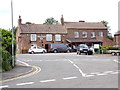
Chequers Inn Public House, Fridaybridge
Off the B1101 March Road at the junction with the Well End, B1101 Main Road, Malting Drove & Back Road
Image: © Geographer
Taken: 9 Jun 2019
0.00 miles
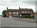
3
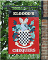
The sign at The Chequers Inn, Friday Bridge
Image: © Adrian S Pye
Taken: 9 May 2019
0.01 miles
4

Village Sign
The new village sign recently erected following development of new houses.
Image: © Tony Bennett
Taken: 22 Dec 2010
0.02 miles
5
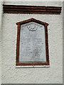
Memorial tablet on the Friday Bridge War Memorial clock tower
The tablet bears the names of the 24 men lost in The Great War.
https://www.geograph.org.uk/photo/6145932
Image: © Adrian S Pye
Taken: 9 May 2019
0.02 miles
6
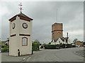
Friday Bridge War Memorial
The clock tower was built in Honour and in Memory of the 24 men lost in The Great War. On the north face the names of those men are written on a tablet https://www.geograph.org.uk/photo/6145934
Image: © Adrian S Pye
Taken: 9 May 2019
0.02 miles
7
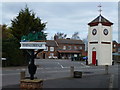
The centre of Friday Bridge near Wisbech
The village sign, pub and clock tower
Image: © Richard Humphrey
Taken: 5 Apr 2012
0.02 miles
8
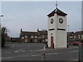
Friday Bridge Clock Tower
The clock tower coming from Upwell.
The Chequers public house in the background.
Image: © Tony Bennett
Taken: 15 Apr 2006
0.02 miles
9
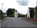
B1101 Main Road, Friday Bridge
At the junction with B1101 March Road, Well End & Maltings Drove
Image: © Geographer
Taken: 9 Jun 2019
0.03 miles
10
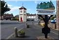
Clock tower in Friday Bridge
The clock tower is also the war memorial.
Image: © Mat Fascione
Taken: 10 Jul 2016
0.03 miles