
IMAGES TAKEN NEAR TO
Eaglesthorpe, PETERBOROUGH, PE1 3RR
Introduction
This page details the photographs taken nearby to Eaglesthorpe, PE1 3RR by members of the Geograph project.
The Geograph project started in 2005 with the aim of publishing, organising and preserving representative images for every square kilometre of Great Britain, Ireland and the Isle of Man.

There are currently over 7.5m images from over14,400 individuals and you can help contribute to the project by visiting https://www.geograph.org.uk
Image Map
Images are licensed for reuse under creativecommons.org/licenses/by-sa/2.0
Notes
- Clicking on the map will re-center to the selected point.
- The higher the marker number, the further away the image location is from the centre of the postcode.
Image Listing (34 Images Found)
Images are licensed for reuse under creativecommons.org/licenses/by-sa/2.0
Image
Details
Distance
1
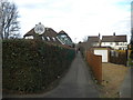
Public footpath off St Paul's Road, New England
The sign prohibiting cycling has become neutral towards that mode of transport as its red circle has faded.
Image: © Richard Vince
Taken: 14 Jan 2017
0.06 miles
2
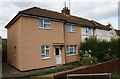
Semi detached houses on St Pauls Road
This pair is #156 and #158
Image: © Roger Templeman
Taken: 12 Sep 2017
0.07 miles
3
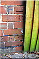
Benchmark on No. 82 Thistlemoor Road
Ordnance Survey cut mark benchmark described on the Bench Mark Database at www.bench-marks.org.uk/bm88579
Image: © phil Richards
Taken: 23 Sep 2017
0.13 miles
4
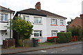
Nos.82 and 80 Thistlemoor Road
There is an Ordnance Survey benchmark Image on the side of the left hand house near its front corner where a wooden fence joins.
Image: © phil Richards
Taken: 23 Sep 2017
0.13 miles
5

St Pauls Road houses at Alexandra Road junction
Ordnance Survey documents indicate that in 1965 a benchmark was levelled at 14.182m above Newlyn Datum on the near corner, left hand face, of the left hand house (No. 63 St Pauls Road) at 20cm above ground level so might still be visible below the cladding.
Image: © phil Richards
Taken: 23 Sep 2017
0.15 miles
6
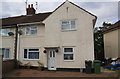
#186 St Pauls Road
There is an OS benchmark Image on the front corner of the house, between the two wheelie bins.
Image: © Roger Templeman
Taken: 12 Sep 2017
0.15 miles
7
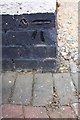
Benchmark on #186 St Pauls Road
Ordnance Survey cut mark benchmark described on the Bench Mark Database at http://www.bench-marks.org.uk/bm88578
Image: © Roger Templeman
Taken: 12 Sep 2017
0.15 miles
8
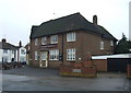
The Northfields public house
On St Paul's Road.
Image: © JThomas
Taken: 3 Apr 2015
0.16 miles
9

The Northfields public house
On St Paul's Road.
Image: © JThomas
Taken: 3 Apr 2015
0.16 miles
10
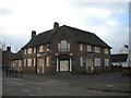
The Northfields, Dogsthorpe
This pub, on the corner of Vere Road (left) and St Paul's Road, has closed since it was last Geographed in April 2015.
Image: © Richard Vince
Taken: 14 Jan 2017
0.16 miles