
IMAGES TAKEN NEAR TO
Little Dowgate, WISBECH, PE13 5DL
Introduction
This page details the photographs taken nearby to Little Dowgate, PE13 5DL by members of the Geograph project.
The Geograph project started in 2005 with the aim of publishing, organising and preserving representative images for every square kilometre of Great Britain, Ireland and the Isle of Man.

There are currently over 7.5m images from over14,400 individuals and you can help contribute to the project by visiting https://www.geograph.org.uk
Image Map
Images are licensed for reuse under creativecommons.org/licenses/by-sa/2.0
Notes
- Clicking on the map will re-center to the selected point.
- The higher the marker number, the further away the image location is from the centre of the postcode.
Image Listing (13 Images Found)
Images are licensed for reuse under creativecommons.org/licenses/by-sa/2.0
Image
Details
Distance


3

Row of Houses on Sutton Road near Wisbech
Entering Wisbech on A1101.
Image: © J.Hannan-Briggs
Taken: 8 Jul 2013
0.09 miles
4
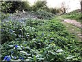
Wild flowers and footpath on an old sea bank in Leverington
Image: © Richard Humphrey
Taken: 7 Apr 2020
0.09 miles
5

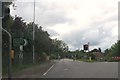
Dowgate Road, Wisbech
The B1169 heads out of town.
Image: © Robin Webster
Taken: 12 Feb 2018
0.10 miles
6

Rabbit Hill on Dowgate Road, Leverington
Rabbit Hill is a scheduled monument but both the age and origin are uncertain - a barrow, a civil war gun emplacement and saltern mound are 3 theories listed on this English Heritage site, see http://www.pastscape.org.uk/hob.aspx?hob_id=355085
Image: © Richard Humphrey
Taken: 6 Jun 2013
0.11 miles
7
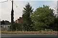
Dowgate Road, Wisbech
The row of houses are on Sutton Road.
Image: © David Howard
Taken: 14 Aug 2022
0.14 miles
9
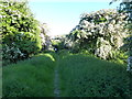
"Roman Bank" in Leverington
This old sea bank was once the edge of The Wash, which extended in a long triangular marsh from the current coastline north of Sutton Bridge to nearby Wisbech. The River Nene meandered through the marshes between this bank and one on its eastern side, see http://www.geograph.org.uk/photo/2207164
Goods were transported from ships on The Nene to the village along several large creeks through the marshes and there are still several large properties which evolved from rich merchants houses in the village. In 1773 The River Nene was straightened between Wisbech and Tydd and the marshes were slowly reclaimed from The Wash. See http://www.british-history.ac.uk/report.aspx?compid=21916&strquery=bank for more information
Image: © Richard Humphrey
Taken: 6 Jun 2013
0.18 miles
