
IMAGES TAKEN NEAR TO
Parson Drove Lane, WISBECH, PE13 5AP
Introduction
This page details the photographs taken nearby to Parson Drove Lane, PE13 5AP by members of the Geograph project.
The Geograph project started in 2005 with the aim of publishing, organising and preserving representative images for every square kilometre of Great Britain, Ireland and the Isle of Man.

There are currently over 7.5m images from over14,400 individuals and you can help contribute to the project by visiting https://www.geograph.org.uk
Image Map
Images are licensed for reuse under creativecommons.org/licenses/by-sa/2.0
Notes
- Clicking on the map will re-center to the selected point.
- The higher the marker number, the further away the image location is from the centre of the postcode.
Image Listing (22 Images Found)
Images are licensed for reuse under creativecommons.org/licenses/by-sa/2.0
Image
Details
Distance


4
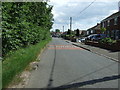
National Cycle Route 1
Roman Bank heading south, Leverington.
Image: © JThomas
Taken: 27 Jun 2015
0.09 miles
5
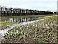
Flooded farmland north of Parson Drove Lane near Leverington
Heavy rainfall over a 6 week period has resulted in the fenland soil becoming totally saturated and many fields in the Fens have large areas of water laying on them.
Image: © Richard Humphrey
Taken: 3 Feb 2021
0.09 miles
7

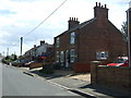
Floodwater on Parson Drove Lane near Leverington in early February 2021
Heavy rainfall over a 6 week period has resulted in the fenland soil becoming totally saturated and many fields in the Fens have large areas of water laying on them.
Image: © Richard Humphrey
Taken: 3 Feb 2021
0.12 miles
8

Flooding on Parson Drove Lane near Leverington
Image: © Richard Humphrey
Taken: 3 Feb 2021
0.15 miles
9
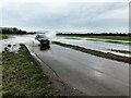
Driving through flood water on Parson Drove Lane near Leverington
Heavy rainfall over a 6 week period has resulted in the fenland soil becoming totally saturated and many fields in the Fens have large areas of water laying on them.
Image: © Richard Humphrey
Taken: 3 Feb 2021
0.15 miles
10

Flooded land off Parson Drove Lane near Leverington
2023 was one of the wettest years on record in the Fens. High levels of rainfall continued through January and February of 2024 and the ground became totally saturated and numerous fields were flooded every time there was any rain for a few hours.
Image: © Richard Humphrey
Taken: 3 Mar 2024
0.15 miles