
IMAGES TAKEN NEAR TO
Cannon Close, WISBECH, PE13 4RB
Introduction
This page details the photographs taken nearby to Cannon Close, PE13 4RB by members of the Geograph project.
The Geograph project started in 2005 with the aim of publishing, organising and preserving representative images for every square kilometre of Great Britain, Ireland and the Isle of Man.

There are currently over 7.5m images from over14,400 individuals and you can help contribute to the project by visiting https://www.geograph.org.uk
Image Map
Images are licensed for reuse under creativecommons.org/licenses/by-sa/2.0
Notes
- Clicking on the map will re-center to the selected point.
- The higher the marker number, the further away the image location is from the centre of the postcode.
Image Listing (57 Images Found)
Images are licensed for reuse under creativecommons.org/licenses/by-sa/2.0
Image
Details
Distance


3

Snow covered junction
The junction of Chapel Avenue and High Road, Wisbech St Mary
Image: © Richard Humphrey
Taken: 9 Jan 2010
0.03 miles
4
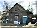
Renovation of former Primitive Methodists Chapel in Wisbech St Mary
For a photo taken in 2009 see https://www.geograph.org.uk/photo/1438887
Image: © Richard Humphrey
Taken: 14 Mar 2021
0.05 miles
5

Former Primitive Methodists Chapel, Wisbech St Mary
Situated on the High Road this chapel built in 1891 has not been used as a chapel for many years.http://www.british-history.ac.uk/report.aspx?compid=21922#s3
Image: © Richard Humphrey
Taken: 11 Aug 2009
0.05 miles
6
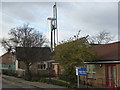
Pile drilling at Wisbech St Mary School
Foundation work taking place on an extension to the village primary school.
Image: © Richard Humphrey
Taken: 5 Dec 2013
0.07 miles
7

Wisbech St Mary School - Pile drilling machine
Foundation working taking place prior to a new room being built on the village school, see http://www.fenland.gov.uk/publicaccess/DocMan/Planning/2013/0601_0750/F_YR13_0616_F/2013-08-16%2013-3778-02A%20Existing%20and%20Proposed%20Floor%20Plans%20and%20Elevations.pdf for plans of work
Image: © Richard Humphrey
Taken: 5 Dec 2013
0.07 miles
8
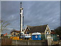
Pile drilling machine at Wisbech St Mary Primary School
For details of this additional building see http://www.fenland.gov.uk/publicaccess/DocMan/Planning/2013/0601_0750/F_YR13_0616_F/2013-08-16%2013-3778-02A%20Existing%20and%20Proposed%20Floor%20Plans%20and%20Elevations.pdf
Image: © Richard Humphrey
Taken: 5 Dec 2013
0.07 miles
9

School and Church Road, Wisbech St Mary
http://www.british-history.ac.uk/report.aspx?compid=21922 http://www.wisbechstmary.org.uk/
Image: © Richard Humphrey
Taken: 20 Dec 2009
0.08 miles
10

School on Church Road, Wisbech St Mary
Image: © Richard Humphrey
Taken: 5 Feb 2012
0.08 miles