
IMAGES TAKEN NEAR TO
Back Road, WISBECH, PE13 4PE
Introduction
This page details the photographs taken nearby to Back Road, PE13 4PE by members of the Geograph project.
The Geograph project started in 2005 with the aim of publishing, organising and preserving representative images for every square kilometre of Great Britain, Ireland and the Isle of Man.

There are currently over 7.5m images from over14,400 individuals and you can help contribute to the project by visiting https://www.geograph.org.uk
Image Map
Images are licensed for reuse under creativecommons.org/licenses/by-sa/2.0
Notes
- Clicking on the map will re-center to the selected point.
- The higher the marker number, the further away the image location is from the centre of the postcode.
Image Listing (19 Images Found)
Images are licensed for reuse under creativecommons.org/licenses/by-sa/2.0
Image
Details
Distance
3
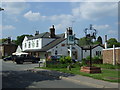
The Woodmans Cottage pub, Gorefield
On High Road.
Image: © JThomas
Taken: 17 May 2014
0.07 miles
9

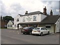
Foundation stone - Gorefield Sunday School and Parish Room
This hall next to the church, see http://www.geograph.org.uk/photo/3755720, has had a number of uses over the last 100 years. My great grand father, Edward Hugh Humphrey was present when the stone was laid in his capacity as church warden. He was the 8th son of William Humphrey, also a church warden, who is buried in the nearby church yard, see http://www.geograph.org.uk/photo/3753631
Image: © Richard Humphrey
Taken: 22 Nov 2013
0.19 miles
10
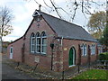
Gorefield Village Hall
Built in 1904 as Gorefield Sunday School and Parish Room. This building served as a village hall for many years prior to the opening of a new village Community Hall on Wolf lane in 2012.
See http://www.geograph.org.uk/photo/3755769 for details on the plaque below the window
Image: © Richard Humphrey
Taken: 22 Nov 2013
0.19 miles