
IMAGES TAKEN NEAR TO
Fen Road, WISBECH, PE13 4AA
Introduction
This page details the photographs taken nearby to Fen Road, PE13 4AA by members of the Geograph project.
The Geograph project started in 2005 with the aim of publishing, organising and preserving representative images for every square kilometre of Great Britain, Ireland and the Isle of Man.

There are currently over 7.5m images from over14,400 individuals and you can help contribute to the project by visiting https://www.geograph.org.uk
Image Map
Images are licensed for reuse under creativecommons.org/licenses/by-sa/2.0
Notes
- Clicking on the map will re-center to the selected point.
- The higher the marker number, the further away the image location is from the centre of the postcode.
Image Listing (41 Images Found)
Images are licensed for reuse under creativecommons.org/licenses/by-sa/2.0
Image
Details
Distance


3
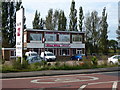
Kiss Kiss Kiss goodbye - Adult Superstore in Guyhirn has closed
This Adult Superstore, or sex shop to most people, operated from this former Little Chef premises for a number of years. It would appear that no retailers are safe in the current recession, see http://www.cambstimes.co.uk/news/owners_kiss_goodbye_to_kiss_kiss_sex_shop_that_once_caused_councillor_s_resignation_1_1516833
Image: © Richard Humphrey
Taken: 28 Sep 2012
0.06 miles

5

Ring's End, A47, Gull Bank and River Nene: aerial 2016
Image: © Chris
Taken: 15 May 2016
0.13 miles
6

Gate and path along the raised bank of the River Nene
Image: © Mat Fascione
Taken: 10 Apr 2016
0.14 miles

8
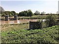
Support columns of the former railway bridge in Guyhirn
Only the support columns remain of the railway bridge which once carried The GE & GN Joint Line from Spalding to March over The River Nene. The line closed in November 1982 and the bridge was removed several years later.
Image: © Richard Humphrey
Taken: 10 Apr 2020
0.17 miles
9

A straight channel all the way to Peterborough
A view of the River Nene from Guyhirn bridge looking towards Peterborough.This straight channel was dug in the 18th century - the river used to flow from Wisbech to March and beyond. http://www.bbc.co.uk/cambridgeshire/natural_history/cycle_through_time/04.shtml
Image: © Richard Humphrey
Taken: 4 Mar 2010
0.17 miles
10
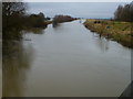
The River Nene at Guyhirn bridge
...
Image: © Richard Humphrey
Taken: 28 Dec 2012
0.17 miles