
IMAGES TAKEN NEAR TO
Mount Pleasant Road, WISBECH, PE13 3NF
Introduction
This page details the photographs taken nearby to Mount Pleasant Road, PE13 3NF by members of the Geograph project.
The Geograph project started in 2005 with the aim of publishing, organising and preserving representative images for every square kilometre of Great Britain, Ireland and the Isle of Man.

There are currently over 7.5m images from over14,400 individuals and you can help contribute to the project by visiting https://www.geograph.org.uk
Image Map
Images are licensed for reuse under creativecommons.org/licenses/by-sa/2.0
Notes
- Clicking on the map will re-center to the selected point.
- The higher the marker number, the further away the image location is from the centre of the postcode.
Image Listing (49 Images Found)
Images are licensed for reuse under creativecommons.org/licenses/by-sa/2.0
Image
Details
Distance
1

Cemetery Chapel, Wisbech
On Mount Pleasant Road.
Image: © JThomas
Taken: 2 Aug 2014
0.04 miles
2

Cemetery Chapel, Wisbech
Dates from 1881 https://historicengland.org.uk/listing/the-list/list-entry/1126663
Image: © Jonathan Thacker
Taken: 9 May 2021
0.04 miles
3
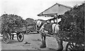
Cartloads of pea vines at Smedley's canning factory, Wisbech - c.1930
When peas were first canned the vines were cut on the fields and loaded by hand onto carts and taken to the factory by horse. Just under the roofline of the building you can see an elevator taking the pea vines to a static pea viner which threshed the vines, separating the vines and pods from the peas, which then went onto the production lines where they were sorted, canned and then sterilized.
Understandably the building was known as The Viner Shed in the 1930s and even though vining equipment was removed a few decades later this building was always known by the same name until it was demolished around the turn of the century to make way for redevelopment of the factory.
By the 1950s pea viners were housed on the growers' farms and the peas were transported to the factory without the vines or pods. The static viners were housed in sheds like this one https://www.geograph.org.uk/photo/3126240.
In turn static viners were replaced by mobile pea viners, see https://www.geograph.org.uk/photo/3073599.
The cannery first opened by Smedley's is still in operation today, see https://www.geograph.org.uk/photo/4217181 and https://www.geograph.org.uk/photo/6420663
(The year of this photo is estimated, corrections welcome)
Image: © The Humphrey family archive
Taken: Unknown
0.10 miles
4

Fir tree in the centre of Wisbech (Mount Pleasant) cemetery
Species unknown
Image: © Adrian S Pye
Taken: 28 Nov 2016
0.12 miles
5
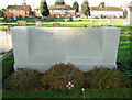
Screen Wall in Wisbech cemetery
The memorial recalls the names of nine men lost in WW1 and of one in WW2. These are included with the official figures of 34 WW1 and 26 WW2 casualties buried here.
Image: © Adrian S Pye
Taken: 28 Nov 2016
0.12 miles
6
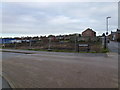
Nene Waterfront regeneration, Wisbech - No 9
At the junction of Cotterell Way and De Havilland Road
This is part of a large area on the side of The River Nene which was razed to the ground years ago and has been overgrown ever since. At long last work on the construction of new housing has recently started.
The site was previously occupied by the town's gasworks, a grain handling facility, light industry, a nightclub and Victorian housing
Image: © Richard Humphrey
Taken: 13 Nov 2015
0.14 miles
7
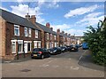
Opportune Road, Wisbech
A row of semi-detached houses
Image: © Eirian Evans
Taken: 24 Jul 2022
0.14 miles
8
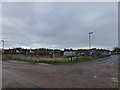
Nene Waterfront regeneration, Wisbech - No 5
At the junction of Cotterell Way and Chase Street
This is part of a large area on the side of The River Nene which was razed to the ground years ago and has been overgrown ever since. At long last work on the construction of new housing has recently started.
The site was previously occupied by the town's gasworks, a grain handling facility, light industry, a nightclub and Victorian housing
Image: © Richard Humphrey
Taken: 13 Nov 2015
0.15 miles
9
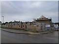
Nene Waterfront regeneration, Wisbech - No 8
This is part of a large area on the side of The River Nene which was razed to the ground years ago and has been overgrown ever since. At long last work on the construction of new housing has recently started.
The site was previously occupied by the town's gasworks, a grain handling facility, light industry, a nightclub and Victorian housing
Image: © Richard Humphrey
Taken: 13 Nov 2015
0.17 miles
10
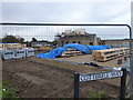
Nene Waterfront regeneration, Wisbech - No 10
At the junction of Cotterell Way and De Havilland Road
This is part of a large area on the side of The River Nene which was razed to the ground years ago and has been overgrown ever since. At long last work on the construction of new housing has recently started.
The site was previously occupied by the town's gasworks, a grain handling facility, light industry, a nightclub and Victorian housing
Image: © Richard Humphrey
Taken: 13 Nov 2015
0.18 miles