
IMAGES TAKEN NEAR TO
Ingleberry Caravan Site, Osborne Road, WISBECH, PE13 3JU
Introduction
This page details the photographs taken nearby to Ingleberry Caravan Site, Osborne Road, PE13 3JU by members of the Geograph project.
The Geograph project started in 2005 with the aim of publishing, organising and preserving representative images for every square kilometre of Great Britain, Ireland and the Isle of Man.

There are currently over 7.5m images from over14,400 individuals and you can help contribute to the project by visiting https://www.geograph.org.uk
Image Map
Images are licensed for reuse under creativecommons.org/licenses/by-sa/2.0
Notes
- Clicking on the map will re-center to the selected point.
- The higher the marker number, the further away the image location is from the centre of the postcode.
Image Listing (41 Images Found)
Images are licensed for reuse under creativecommons.org/licenses/by-sa/2.0
Image
Details
Distance
1

Wisbech - Ingleberry Caravan Park
A curious place, tucked between Osborne Road and the industrial facilities around the port.
Image: © Peter Whatley
Taken: 21 Apr 2010
0.01 miles
2

Wisbech - waste ground off Osborne Road
Image: © Peter Whatley
Taken: 21 Apr 2010
0.03 miles


5

Wisbech - Old and new, Savory Road
Various houses on Savory Road retain a timber fronted facade. Most have been rebuilt in the manner of the left-hand house. That on the right is being rebuilt to a similar style.
Image: © Peter Whatley
Taken: 21 Apr 2010
0.11 miles
6

Swinging basin and boat lift
The swinging basin allows ships from the Port of Wisbech to turn around, while the boat lift allows rather smaller boats to be hoisted up into Crab Marsh boatyard.
Image: © Ben Harris
Taken: 30 Jun 2012
0.12 miles
7

Turning Bay at Crab Marsh
Used for turning Ships, so they can head out bow first. After tipping at Wisbech Port
Image: © Tony Bennett
Taken: 14 Sep 2008
0.12 miles
8
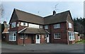
The Shipwrights Arms - Public Houses, Inns and Taverns of Wisbech
This former public house is located on the junction of Crab Marsh and Brigstock Road in Wisbech. According to AA Oldham's book this pub was built in 1930 on the site of a pub with the same name. The 1994 CAMRA report records it as trading as The Four Jacks. It is now a domestic dwelling with rooms to let.
The old wall mounted sign can be seen here http://www.geograph.org.uk/photo/4828233
Image: © Richard Humphrey
Taken: 12 Feb 2016
0.13 miles
9

The former Shipwright's Arms, Wisbech
In the port area of the town. Dates from 1930.
Image: © Jonathan Thacker
Taken: 9 May 2021
0.13 miles
10
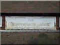
The Shipwrights Arms (Sign) - Public Houses, Inns and Taverns of Wisbech
This former public house is located on the junction of Crab Marsh and Brigstock Road in Wisbech. According to AA Oldham's book this pub was built in 1930 on the site of a pub with the same name. The 1994 CAMRA report records it as trading as The Four Jacks. It is now a domestic dwelling with rooms to let.
The complete building can be seen in this photo http://www.geograph.org.uk/photo/4828209
Image: © Richard Humphrey
Taken: 12 Feb 2016
0.13 miles