IMAGES TAKEN NEAR TO
Kooreman Avenue, WISBECH, PE13 3HY
Introduction
This page details the photographs taken nearby to Kooreman Avenue, PE13 3HY by members of the Geograph project.
The Geograph project started in 2005 with the aim of publishing, organising and preserving representative images for every square kilometre of Great Britain, Ireland and the Isle of Man.

There are currently over 7.5m images from over14,400 individuals and you can help contribute to the project by visiting https://www.geograph.org.uk
Image Map
Images are licensed for reuse under creativecommons.org/licenses/by-sa/2.0
Notes
- Clicking on the map will re-center to the selected point.
- The higher the marker number, the further away the image location is from the centre of the postcode.
Image Listing (20 Images Found)
Images are licensed for reuse under creativecommons.org/licenses/by-sa/2.0
Image
Details
Distance
1
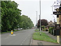
Lynn Road near The Locomotive public house
Image: © Adrian S Pye
Taken: 19 May 2019
0.05 miles
2
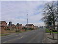
Lynn Road, Wisbech
Cycle Route 1 crosses the road here, and turns left up Kooreman Avenue
Image: © Tim Heaton
Taken: 6 Feb 2017
0.06 miles
3
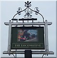
The Locomotive (Sign) - Public Houses, Inns and Taverns of Wisbech
This public house is on Lynn Road in Wisbech. The photographer has drunk in this pub. The complete building can be seen in this photo http://www.geograph.org.uk/photo/4842052
Image: © Richard Humphrey
Taken: 26 Feb 2016
0.07 miles
4
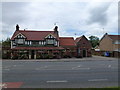
The Black Buoy Low (Site of) - Public Houses, Inns and Taverns of Wisbech
This is the site of a former inn, The Black Buoy Low (Black Boy Low?) which once stood on, or very close to, this current pub, The Locomotive.
Extensive research of newspaper articles and old maps indicates The Black Buoy Low was sold in 1855 (and possibly demolished?) and The Locomotive Inn built on the site, it has a date stone in the gable end - Rebuilt 1857
The Black Boy Low was named in some sale particulars and a map http://media.geograph.org.uk/view.php?id=2224 of adjacent land in 1870 although the map used could have been historical, ie pre 1855
This sketch http://media.geograph.org.uk/view.php?id=2225 by Alexander Peckover in 1847 (© Wisbech and Fenland Museum) is titled The Black Boy Low and it may well be the inn viewed from the north looking towards Lynn Road
Image: © Richard Humphrey
Taken: 14 Jul 2017
0.08 miles
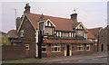
6
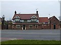
The Locomotive - Public Houses, Inns and Taverns of Wisbech
This public house is on Lynn Road in Wisbech. The photographer has drunk in this pub. The current sign can be seen in this photo http://www.geograph.org.uk/photo/4842063
Image: © Richard Humphrey
Taken: 26 Feb 2016
0.08 miles
7
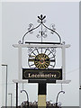
The sign for The Locomotive public house
https://www.geograph.org.uk/photo/6155987
Image: © Adrian S Pye
Taken: 19 May 2019
0.08 miles
8
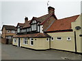
The Locomotive public house, Lynn Rd, Wisbech
https://www.geograph.org.uk/photo/6155989
Image: © Adrian S Pye
Taken: 19 May 2019
0.08 miles