
IMAGES TAKEN NEAR TO
St. Augustines Road, WISBECH, PE13 3AH
Introduction
This page details the photographs taken nearby to St. Augustines Road, PE13 3AH by members of the Geograph project.
The Geograph project started in 2005 with the aim of publishing, organising and preserving representative images for every square kilometre of Great Britain, Ireland and the Isle of Man.

There are currently over 7.5m images from over14,400 individuals and you can help contribute to the project by visiting https://www.geograph.org.uk
Image Map
Images are licensed for reuse under creativecommons.org/licenses/by-sa/2.0
Notes
- Clicking on the map will re-center to the selected point.
- The higher the marker number, the further away the image location is from the centre of the postcode.
Image Listing (412 Images Found)
Images are licensed for reuse under creativecommons.org/licenses/by-sa/2.0
Image
Details
Distance
1

St Augustine's Church, Lynn Road, Wisbech
Image: © Dr Charles Nelson
Taken: 26 Oct 2005
0.02 miles
2
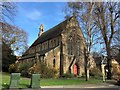
St Augustine's Church in Wisbech
On the junction of Lynn Road and St Augustine's Road
Image: © Richard Humphrey
Taken: 21 Mar 2020
0.03 miles
3

St Augustine's Road, Wisbech
Looking southward from the junction with Lynn Road (the B198). St Augustine's Road was formerly known as Monica Road.
Image: © Barbara Carr
Taken: 29 Sep 2009
0.04 miles
4
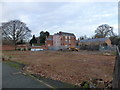
Redevelopment of the former Collett's site in Wisbech
This site, between Churchill Road and St Augustine's Road, was previously occupied a builders merchants, Isaac Collett & Sons (1964) Ltd.
Image: © Richard Humphrey
Taken: 8 Jan 2016
0.05 miles
5

The remains of The Blackfriars pub, Wisbech
Yet another landmark in Wisbech was destroyed by a suspected arson attack. This fire, in the early hours of Monday 6th September, is the fourth major fire in Wisbech in 2010. Once again more demolition and salvage work for David Humphrey & Son who were busy clearing the site when this photo was taken. For the fire at Constantine House (The Belfast) see http://www.geograph.org.uk/photo/1795609 for the fire at The Phoenix Hotel see http://www.geograph.org.uk/photo/1855515 and for the fire at The Flower Pot pub see http://www.geograph.org.uk/photo/1856362
Image: © Richard Humphrey
Taken: 9 Sep 2010
0.05 miles
6

New houses near The Horsefair in Wisbech
Looking over Churchill Road from the upper floor of The Horsefair car park at this housing development nearing completion.
Image: © Richard Humphrey
Taken: 23 Sep 2016
0.05 miles
7

Former almshouses on Lynn Road, Wisbech
The wording over the front door reads -
DIAMOND JUBILEE ALMSHOUSES
1897
BUILT AND ENDOWED BY
GEORGE WILLIAM MILLS
Image: © Richard Humphrey
Taken: 21 Mar 2020
0.05 miles
8

Unconventional brickwork in a wall near Wisbech Park
Image: © Richard Humphrey
Taken: 21 Mar 2020
0.05 miles
9

Three houses being built on Churchill Road, Wisbech
Image: © Richard Humphrey
Taken: 30 Jul 2016
0.06 miles
10

Housing under construction on Churchill Road, Wisbech
Image: © Richard Humphrey
Taken: 30 Jul 2016
0.06 miles