
IMAGES TAKEN NEAR TO
Cannon Street, WISBECH, PE13 2UZ
Introduction
This page details the photographs taken nearby to Cannon Street, PE13 2UZ by members of the Geograph project.
The Geograph project started in 2005 with the aim of publishing, organising and preserving representative images for every square kilometre of Great Britain, Ireland and the Isle of Man.

There are currently over 7.5m images from over14,400 individuals and you can help contribute to the project by visiting https://www.geograph.org.uk
Image Map
Images are licensed for reuse under creativecommons.org/licenses/by-sa/2.0
Notes
- Clicking on the map will re-center to the selected point.
- The higher the marker number, the further away the image location is from the centre of the postcode.
Image Listing (226 Images Found)
Images are licensed for reuse under creativecommons.org/licenses/by-sa/2.0
Image
Details
Distance
1
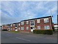
The Crown Tavern (Site of) - Public Houses, Inns and Taverns of Wisbech
This is the site of a former tavern, The Crown Tavern, which stood at 15 West Street, formerly Little South Street. A photo of the tavern can be seen here http://media.geograph.org.uk/view.php?id=1130 when it traded as The Crown Hotel.
This tavern's location is shown on a map of Wisbech which was surveyed and drawn in 1853 as part of The Public Health Act of 1848 https://media.geograph.org.uk/view.php?id=2678
The site is now occupied by flats.
Image: © Richard Humphrey
Taken: 30 Apr 2017
0.03 miles
2
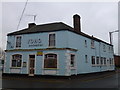
The Ferry House (Ferry Boat) - Public Houses, Inns and Taverns of Wisbech
This building was once The Ferry House at 87 Norfolk Street, Wisbech. It closed in the 1990s. The photographer has drunk in this pub before it closed. It's earlier name was The Ferry Boat. It is now a Chinese restaurant up for sale.
Image: © Richard Humphrey
Taken: 11 Jan 2016
0.04 miles
3
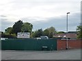
The Dun Cow (Site of) - Public Houses, Inns and Taverns of Wisbech
This is the site of a former inn, The Dun Cow, which stood on the corner of Victoria Road and West Street. A sketch and photo of it can be seen here http://media.geograph.org.uk/view.php?id=2172 and here http://media.geograph.org.uk/view.php?id=1842
The site is currently an employment agency/gang-master's yard operated by Fred Bassett & Son
This inn's location is shown on a map of Wisbech which was surveyed and drawn in 1853 as part of The Public Health Act of 1848 https://media.geograph.org.uk/view.php?id=2678
Image: © Richard Humphrey
Taken: 30 Apr 2017
0.04 miles
4
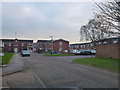
The Woolpack (Site of) - Public Houses, Inns and Taverns of Wisbech
This is the site of a former pub, The Woolpack, which stood on Norfolk Street (East), Wisbech. At the time of its closure in the mid 1970s it was one of the most popular pubs in the town and would be "heaving" every weekend. The photographer has drunk in this pub before it closed. The entire southern section of Norfolk Street (East) was subsequently demolished and replaced with Onyx Court in 1979.
For an old photo looking in the same direction see http://media.geograph.org.uk/view.php?id=1139
Image: © Richard Humphrey
Taken: 19 Jan 2016
0.05 miles
5
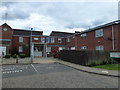
The White Horse Inn (Site of) - Public Houses, Inns and Taverns of Wisbech
This is the site of a former inn, The White Horse Inn, which once stood on the west side of Great South Street, later called Norfolk Street and now Onyx Court. The orininal road has now been built over and is occupied by the flats of Onyx Court.
This inn once stood next door to another inn, The Red Cow, see http://www.geograph.org.uk/photo/5465611
This inn's location is shown on a map of Wisbech which was surveyed and drawn in 1853 as part of The Public Health Act of 1848 https://media.geograph.org.uk/view.php?id=2678
(This inn is not mentioned in AA Oldham's book The Inns and Taverns of Wisbech)
Image: © Richard Humphrey
Taken: 14 Jul 2017
0.06 miles
6
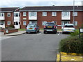
The Red Cow Inn (Site of) - Public Houses, Inns and Taverns of Wisbech
This is the site of a former inn, The Red Cow Inn, which once stood on the west side of Great South Street, later called Norfolk Street and now Onyx Court. The original road has now been built over and is occupied by the flats of Onyx Court.
This inn once stood next door to another inn, The White Horse Inn, see http://www.geograph.org.uk/photo/5465598
This inn's location is shown on a map of Wisbech which was surveyed and drawn in 1853 as part of The Public Health Act of 1848 https://media.geograph.org.uk/view.php?id=2678
Image: © Richard Humphrey
Taken: 14 Jul 2017
0.06 miles
7
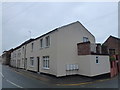
The Unicorn (Harlequin / Chameleon) - Public Houses, Inns and Taverns of Wisbech
This building was once The Unicorn Inn at 55-57 West Street, Wisbech. It was renamed The Harlequin and then The Chameleon for several years before it closed in 2013. The photographer has drunk in this pub before it closed. It is now domestic dwellings.
For an old photo see http://media.geograph.org.uk/view.php?id=1140
Image: © Richard Humphrey
Taken: 11 Jan 2016
0.07 miles
8
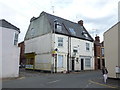
Former Inn - Public Houses, Inns and Taverns of Wisbech
...
Image: © Richard Humphrey
Taken: 14 Jul 2017
0.07 miles
9
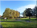
Tillery Field, Wisbech
A small public park and former graveyard
The information board relates the history of the park from the 14th century when the area was called Le Tyllerie, meaning a "place where tiles are made". In 1828 it became the New Burial Ground, an overflow graveyard for the Church of St Peter and St Paul.
Image: © Richard Humphrey
Taken: 18 Nov 2016
0.08 miles
10
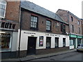
The Five Bells - Public Houses, Inns and Taverns of Wisbech
This historic public house is at 13 Norfolk Street Wisbech. The photographer has drunk in this pub. The current sign can be seen in this photo http://www.geograph.org.uk/photo/4855530. It dates back to the mid 18th century and the date stone can be seen in this photo http://www.geograph.org.uk/photo/4855516.
It currently appears to be closed and for sale with an asking price in excess of £200,000
Image: © Richard Humphrey
Taken: 7 Mar 2016
0.09 miles