IMAGES TAKEN NEAR TO
Trotwood Mews, WISBECH, PE13 2HL
Introduction
This page details the photographs taken nearby to Trotwood Mews, PE13 2HL by members of the Geograph project.
The Geograph project started in 2005 with the aim of publishing, organising and preserving representative images for every square kilometre of Great Britain, Ireland and the Isle of Man.

There are currently over 7.5m images from over14,400 individuals and you can help contribute to the project by visiting https://www.geograph.org.uk
Image Map
Images are licensed for reuse under creativecommons.org/licenses/by-sa/2.0
Notes
- Clicking on the map will re-center to the selected point.
- The higher the marker number, the further away the image location is from the centre of the postcode.
Image Listing (22 Images Found)
Images are licensed for reuse under creativecommons.org/licenses/by-sa/2.0
Image
Details
Distance
1

Wisbech - Kingswood Park
A relatively new, fill-in development off Ramnoth Road.
Image: © Peter Whatley
Taken: 21 Apr 2010
0.06 miles
2

Plots 66 to 69, Copperfields, Wisbech, Cambridgeshire
These four new town houses had been completed and sold, but were not yet in occupation when photographed. They are typical of the high standard of new homes being built in the town.
Image: © Dr Neil Clifton
Taken: 11 Apr 2007
0.07 miles
3

Awdry House.
New council children services office building named after the local author the Reverend Wilbert Vere Awdry, creator of Thomas the Tank Engine.
Image: © Tony Bennett
Taken: 2 May 2013
0.09 miles
4

Land awaiting development in Wisbech
A large infill plot on the junction of Quaker Lane and Penrose Gardens which had been totally overgrown with bushes for many years
Image: © Richard Humphrey
Taken: 22 Jan 2021
0.12 miles

6

Wisbech - Bill Zamphire Autos
A small dealership based at a house on Ramnoth Road.
Image: © Peter Whatley
Taken: 21 Apr 2010
0.14 miles
7

Quaker Lane
A view soon to change, planning permission has been granted for five houses on the site to the right.
Image: © Jeanie Hale
Taken: Unknown
0.14 miles
8
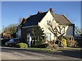
Former railway crossing gate house on Meadowgate Lane in Wisbech
The Wisbech to King's Lynn railway once crossed the road here.
Image: © Richard Humphrey
Taken: 22 Jan 2021
0.14 miles
9

Footpath Sign
Footpath sign situated at the bottom of Stow Lane
Image: © Tony Bennett
Taken: 28 Aug 2011
0.14 miles