
IMAGES TAKEN NEAR TO
Clarkson Avenue, WISBECH, PE13 2EG
Introduction
This page details the photographs taken nearby to Clarkson Avenue, PE13 2EG by members of the Geograph project.
The Geograph project started in 2005 with the aim of publishing, organising and preserving representative images for every square kilometre of Great Britain, Ireland and the Isle of Man.

There are currently over 7.5m images from over14,400 individuals and you can help contribute to the project by visiting https://www.geograph.org.uk
Image Map
Images are licensed for reuse under creativecommons.org/licenses/by-sa/2.0
Notes
- Clicking on the map will re-center to the selected point.
- The higher the marker number, the further away the image location is from the centre of the postcode.
Image Listing (33 Images Found)
Images are licensed for reuse under creativecommons.org/licenses/by-sa/2.0
Image
Details
Distance
1
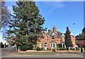
Houses on the junction of Clarkson Avenue and Tavistock Road, Wisbech
Image: © Richard Humphrey
Taken: 21 Mar 2020
0.06 miles
2
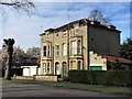
A pair of large semi-detached houses on Clarkson Avenue
Image: © Richard Humphrey
Taken: 21 Mar 2020
0.11 miles
3
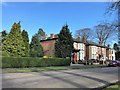
Houses on Clarkson Avenue, Wisbech
Image: © Richard Humphrey
Taken: 21 Mar 2020
0.11 miles


6

Harbour Line
Children's playground in the park.
The path and gates mark the route of the old railway harbour line.
Image: © Tony Bennett
Taken: 28 Aug 2011
0.18 miles
7
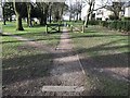
Former route of the Harbour Line railway in Wisbech Park
This branch line served Smedley's canning factory, wood yards and various other businesses in the Wisbech port area. The line was closed in the 1960s.
Image: © Richard Humphrey
Taken: 21 Mar 2020
0.19 miles
8
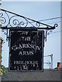
The Clarkson Arms (Sign) - Public Houses, Inns and Taverns of Wisbech
This public house is on Lynn Road, Wisbech. According to AA Oldham's book it was called The Windmill until its name was changed in 1877. The photographer has drunk in this pub. It is known by some people as The Canner's Arms due to its proximity to a large fruit and vegetable canning factory once owned by Smedley's and now owned by Princes. The current pub can be seen in this photo http://www.geograph.org.uk/photo/4939668
Image: © Richard Humphrey
Taken: 4 May 2016
0.19 miles
9
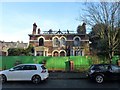
Fire damaged house in Townshend Road, Wisbech
Image: © Richard Humphrey
Taken: 18 Dec 2017
0.20 miles
10
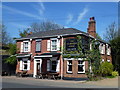
The Clarkson Arms (formerly The Windmill Inn) - Public Houses, Inns and Taverns of Wisbech
This public house is on Lynn Road, Wisbech. According to AA Oldham's book it was called The Windmill until its name was changed in 1877. The photographer has drunk in this pub. It is known by some people as The Canner's Arms due to its proximity to a large fruit and vegetable canning factory once owned by Smedley's and now owned by Princes. The current sign can be seen in this photo http://www.geograph.org.uk/photo/4939687
Image: © Richard Humphrey
Taken: 4 May 2016
0.20 miles