
IMAGES TAKEN NEAR TO
Earl Street, WISBECH, PE13 2AX
Introduction
This page details the photographs taken nearby to Earl Street, PE13 2AX by members of the Geograph project.
The Geograph project started in 2005 with the aim of publishing, organising and preserving representative images for every square kilometre of Great Britain, Ireland and the Isle of Man.

There are currently over 7.5m images from over14,400 individuals and you can help contribute to the project by visiting https://www.geograph.org.uk
Image Map
Images are licensed for reuse under creativecommons.org/licenses/by-sa/2.0
Notes
- Clicking on the map will re-center to the selected point.
- The higher the marker number, the further away the image location is from the centre of the postcode.
Image Listing (141 Images Found)
Images are licensed for reuse under creativecommons.org/licenses/by-sa/2.0
Image
Details
Distance
1
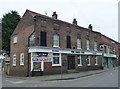
The Three Tuns - Public Houses, Inns and Taverns of Wisbech
This historic public house is on Norwich Road, Wisbech. The photographer has drunk in this pub. An old photo of the pub can be seen here http://wisbech.ccan.co.uk/content/catalogue_item/mr-george-larkins-bakery-shop-norwich-road-near-to-the-three-tuns-pub-his-45-yr-old-daughter-ivy-is-holding-the-pony The current sign can be seen in this photo http://www.geograph.org.uk/photo/4844420
Image: © Richard Humphrey
Taken: 26 Feb 2016
0.09 miles
2
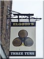
The Three Tuns (Sign) - Public Houses, Inns and Taverns of Wisbech
This historic public house is on Norwich Road, Wisbech. The photographer has drunk in this pub. An old photo of the pub can be seen here http://wisbech.ccan.co.uk/content/catalogue_item/mr-george-larkins-bakery-shop-norwich-road-near-to-the-three-tuns-pub-his-45-yr-old-daughter-ivy-is-holding-the-pony The complete building can be seen in this photo http://www.geograph.org.uk/photo/4844409
Image: © Richard Humphrey
Taken: 26 Feb 2016
0.09 miles
3
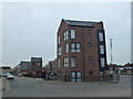
The Royal Exchange (Site of) - Public Houses, Inns and Taverns of Wisbech
This is the site of a former hotel, The Royal Exchange which stood on Norwich Road close to the east bank of the Wisbech canal. The position is shown on the 1900 Ordnance Survey map of Wisbech and also on the map in AA Oldham's book. This photo taken in 1963 http://media.geograph.org.uk/view.php?id=1836 shows the hotel and this photograph taken in 1960, http://media.geograph.org.uk/view.php?id=1100, shows the hotel and street numbering also confirming the location. The site is now occupied by apartments completed in 2015.
It is named on the 1887 OS map of Wisbech, see https://www.old-maps.co.uk/#/Map/546227/310115/13/100091
Image: © Richard Humphrey
Taken: 26 Feb 2016
0.09 miles
4
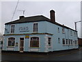
The Ferry House (Ferry Boat) - Public Houses, Inns and Taverns of Wisbech
This building was once The Ferry House at 87 Norfolk Street, Wisbech. It closed in the 1990s. The photographer has drunk in this pub before it closed. It's earlier name was The Ferry Boat. It is now a Chinese restaurant up for sale.
Image: © Richard Humphrey
Taken: 11 Jan 2016
0.13 miles
5
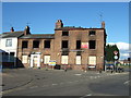
Suspected arson, was it Bill or was it Ben?
Last Thursday, May 6th,the Flower Pot public house, recently sold according to the agents board, became the third large building to be gutted by a fire in Wisbech in the last few weeks. Once again local demolition contractors David Humphrey & Son were called in to fence the building off and board up the windows and doors and make the site safe. For pictures of other fire sites see links http://www.geograph.org.uk/photo/1840360 http://www.geograph.org.uk/photo/1795609
Image: © Richard Humphrey
Taken: 12 May 2010
0.13 miles
6
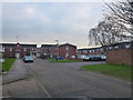
The Woolpack (Site of) - Public Houses, Inns and Taverns of Wisbech
This is the site of a former pub, The Woolpack, which stood on Norfolk Street (East), Wisbech. At the time of its closure in the mid 1970s it was one of the most popular pubs in the town and would be "heaving" every weekend. The photographer has drunk in this pub before it closed. The entire southern section of Norfolk Street (East) was subsequently demolished and replaced with Onyx Court in 1979.
For an old photo looking in the same direction see http://media.geograph.org.uk/view.php?id=1139
Image: © Richard Humphrey
Taken: 19 Jan 2016
0.13 miles
7
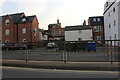
Churchill Road, Wisbech
The little building to the right next to the white ones has had a new floor added in the last year. It also added two new windows below it from a blank wall and door.
Image: © David Howard
Taken: 14 Aug 2022
0.13 miles
8
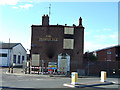
The Flower Pot pub gutted by fire
Wisbech suffered its third major fire in three weeks when this pub was burned out on Thursday 6th May. At present the police do not believe there is any link between the fires, other than David Humphrey & Son getting all the demolition and salvage work! For other fire sites in Wisbech see links http://www.geograph.org.uk/photo/1855515 http://www.geograph.org.uk/photo/1840215
Image: © Richard Humphrey
Taken: 12 May 2010
0.13 miles
9
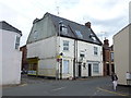
Former Inn - Public Houses, Inns and Taverns of Wisbech
...
Image: © Richard Humphrey
Taken: 14 Jul 2017
0.13 miles
10
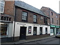
The Five Bells - Public Houses, Inns and Taverns of Wisbech
This historic public house is at 13 Norfolk Street Wisbech. The photographer has drunk in this pub. The current sign can be seen in this photo http://www.geograph.org.uk/photo/4855530. It dates back to the mid 18th century and the date stone can be seen in this photo http://www.geograph.org.uk/photo/4855516.
It currently appears to be closed and for sale with an asking price in excess of £200,000
Image: © Richard Humphrey
Taken: 7 Mar 2016
0.13 miles