
IMAGES TAKEN NEAR TO
West Parade, WISBECH, PE13 1QD
Introduction
This page details the photographs taken nearby to West Parade, PE13 1QD by members of the Geograph project.
The Geograph project started in 2005 with the aim of publishing, organising and preserving representative images for every square kilometre of Great Britain, Ireland and the Isle of Man.

There are currently over 7.5m images from over14,400 individuals and you can help contribute to the project by visiting https://www.geograph.org.uk
Image Map
Images are licensed for reuse under creativecommons.org/licenses/by-sa/2.0
Notes
- Clicking on the map will re-center to the selected point.
- The higher the marker number, the further away the image location is from the centre of the postcode.
Image Listing (299 Images Found)
Images are licensed for reuse under creativecommons.org/licenses/by-sa/2.0
Image
Details
Distance

2
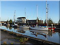
Boathouse and Yacht Harbour in Wisbech
The entire east coast was battered by a 1-in-60 year tidal surge on the night of Thursday 5th December 2013. A combination of a spring tide, 60 mph winds and a North Sea tidal surge caused the highest tides in over 60 years. Although Wisbech is 10 miles from the coast and 20 miles from the North Sea it is still a flood risk area as it sits on the banks of the tidal River Nene. After parts of the town were flooded in 1978 the height of the river banks was raised by about 1.5 metres, railings were replaced by flood walls and a series of flood gates were built. In the last few years the height of these defences has been raised again by another half metre and work is still ongoing today, replacing metal sheeting defences with concrete and brick walls along Nene Quay. Without these additional flood walls, Wisbech would have suffered severe flooding on Thursday, with the water level above the pre-1978 defences and half way up the additional flood walls. This photo was taken just before the next high tide was due on the following morning which was a couple of metres lower than the surge tide the night before.
Image: © Richard Humphrey
Taken: 6 Dec 2013
0.03 miles
3
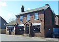
The Lathrender's Arms - Public Houses, Inns and Taverns of Wisbech
This building was once The Lathrenders Arms on North End, Wisbech. The photographer remembers this building being a pub before it was closed (in 1982?) and was converted into a fish and chip shop, The Jolly Fryer
Image: © Richard Humphrey
Taken: 4 Mar 2016
0.03 miles
4

River Nene near Freedom Bridge, Wisbech
Image: © Richard Humphrey
Taken: 24 Sep 2009
0.03 miles

7
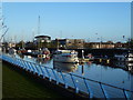
The Boathouse and River Nene in Wisbech
The entire east coast was battered by a 1-in-60 year tidal surge on the night of Thursday 5th December 2013. A combination of a spring tide, 60 mph winds and a North Sea tidal surge caused the highest tides in over 60 years. Although Wisbech is 10 miles from the coast and 20 miles from the North Sea it is still a flood risk area as it sits on the banks of the tidal River Nene. After parts of the town were flooded in 1978 the height of the river banks was raised by about 1.5 metres, railings were replaced by flood walls and a series of flood gates were built. In the last few years the height of these defences has been raised again by another half metre and work is still ongoing today, replacing metal sheeting defences with concrete and brick walls along Nene Quay. Without these additional flood walls, Wisbech would have suffered severe flooding on Thursday, with the water level above the pre-1978 defences and half way up the additional flood walls. This photo was taken just before the next high tide was due on the following morning which was a couple of metres lower than the surge tide the night before.
Image: © Richard Humphrey
Taken: 6 Dec 2013
0.04 miles
8
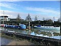
Boats near the Boat House in Wisbech
Moored alongside the floating pontoons which form the marina on the tidal River Nene
Image: © Richard Humphrey
Taken: 6 Jan 2021
0.04 miles
9
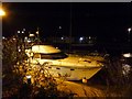
Surge tide on The River Nene in Wisbech - A yacht at street level
On Friday 13th January 2017 high spring tides and a strong northerly gale produced exceptionally high water levels in the town but fortunately the recently improved flood defences were not breached. Flood gates were closed and flood wardens were in position until the threat of flooding had passed.
Image: © Richard Humphrey
Taken: 13 Jan 2017
0.04 miles
10
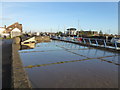
Saved by the flood wall - North End, Wisbech
The previous high tide came over the river edge but was retained by the flood wall built in 1978.
The entire east coast was battered by a 1-in-60 year tidal surge on the night of Thursday 5th December 2013. A combination of a spring tide, 60 mph winds and a North Sea tidal surge caused the highest tides in over 60 years. Although Wisbech is 10 miles from the coast and 20 miles from the North Sea it is still a flood risk area as it sits on the banks of the tidal River Nene. After parts of the town were flooded in 1978 the height of the river banks was raised by about 1.5 metres, railings were replaced by flood walls and a series of flood gates were built. In the last few years the height of these defences has been raised again by another half metre and work is still ongoing today, replacing metal sheeting defences with concrete and brick walls along Nene Quay. Without these additional flood walls, Wisbech would have suffered severe flooding on Thursday, with the water level above the pre-1978 defences and half way up the additional flood walls. This photo was taken just before the next high tide was due on the following morning which was a couple of metres lower than the surge tide the night before.
Image: © Richard Humphrey
Taken: 6 Dec 2013
0.04 miles