
IMAGES TAKEN NEAR TO
Oil Mill Lane, WISBECH, PE13 1NW
Introduction
This page details the photographs taken nearby to Oil Mill Lane, PE13 1NW by members of the Geograph project.
The Geograph project started in 2005 with the aim of publishing, organising and preserving representative images for every square kilometre of Great Britain, Ireland and the Isle of Man.

There are currently over 7.5m images from over14,400 individuals and you can help contribute to the project by visiting https://www.geograph.org.uk
Image Map
Images are licensed for reuse under creativecommons.org/licenses/by-sa/2.0
Notes
- Clicking on the map will re-center to the selected point.
- The higher the marker number, the further away the image location is from the centre of the postcode.
Image Listing (796 Images Found)
Images are licensed for reuse under creativecommons.org/licenses/by-sa/2.0
Image
Details
Distance
1

Shops, Old Market and North Street, Wisbech
Grade II listed buildings to each side of the narrow Oil Mill Lane.
Image: © Robin Webster
Taken: 12 Feb 2018
0.03 miles
2
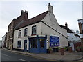
The White Swan Inn (The Swan) - Public Houses, Inns and Taverns of Wisbech
This building was once The White Swan on North Street, Wisbech. It closed about 50 years ago and is currently a shop. The inn sign can be seen in this Lilian Ream photograph dated 1957 http://media.geograph.org.uk/view.php?id=1839
At one time it was also called The Swan.
This inn's location is shown on a map of Wisbech which was surveyed and drawn in 1853 as part of The Public Health Act of 1848, see https://media.geograph.org.uk/view.php?id=2690
Image: © Richard Humphrey
Taken: 8 Jan 2016
0.03 miles
3
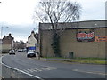
The Ship Defiance Inn (Site of) - Public Houses, Inns and Taverns of Wisbech
This is the site of a former pub, The Ship Defiance, which stood on North Street, Wisbech between the Old Market and The River Nene. The site is now partially occupied by Shapers Gym. See the following links for 2 old photographs http://media.geograph.org.uk/view.php?id=1143 & http://media.geograph.org.uk/view.php?id=1144
This inn's location is shown on a map of Wisbech which was surveyed and drawn in 1853 as part of The Public Health Act of 1848, see https://media.geograph.org.uk/view.php?id=2690
Image: © Richard Humphrey
Taken: 12 Feb 2016
0.03 miles


6

Wisbech - houses on north side of Old Market
For an alternative view, please see Image
Image: © Dave Bevis
Taken: 17 Oct 2011
0.03 miles
7

The Foyer in Wisbech
On the bank of The River Nene near Freedom Bridge.
This was the same view in 1969 http://calm.cambridgeshire.gov.uk/CalmView/GetImage.ashx?db=Catalog&type=default&fname=K_083(9).jpg ©Lilian Ream
Image: © Richard Humphrey
Taken: 23 Nov 2015
0.04 miles
8

'The Counting House' Chapel Road, Wisbech
Image: © Paul Shreeve
Taken: 15 Nov 2009
0.04 miles
9
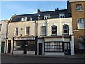
The Elephant and Castle Inn - Public Houses, Inns and Taverns of Wisbech
The cream building on the right was once The Elephant and Castle on North Street, Wisbech which runs from The Old Market to The River Nene.
This tavern's location is shown on a map of Wisbech which was surveyed and drawn in 1853 as part of The Public Health Act of 1848, see https://media.geograph.org.uk/view.php?id=2690
Image: © Richard Humphrey
Taken: 18 Dec 2017
0.04 miles
