
IMAGES TAKEN NEAR TO
Somers Road, WISBECH, PE13 1JF
Introduction
This page details the photographs taken nearby to Somers Road, PE13 1JF by members of the Geograph project.
The Geograph project started in 2005 with the aim of publishing, organising and preserving representative images for every square kilometre of Great Britain, Ireland and the Isle of Man.

There are currently over 7.5m images from over14,400 individuals and you can help contribute to the project by visiting https://www.geograph.org.uk
Image Map
Images are licensed for reuse under creativecommons.org/licenses/by-sa/2.0
Notes
- Clicking on the map will re-center to the selected point.
- The higher the marker number, the further away the image location is from the centre of the postcode.
Image Listing (774 Images Found)
Images are licensed for reuse under creativecommons.org/licenses/by-sa/2.0
Image
Details
Distance
1

Centenary Gardens
Recent addition to the Octavia Hill birthplace museum. The name commemoratives the centenary of her death.
Octavia Hill (1838-1912) was an English social reformer, whose main concern was the welfare of the inhabitants of cities, especially London, in the second half of the nineteenth century.
The museum can be just seen in the background.
Image: © Tony Bennett
Taken: 21 Apr 2013
0.01 miles
2
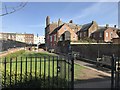
Centenary Green in Wisbech
A garden between Somers Road and Octavia Hill's Birthplace House
For more information see http://www.octaviahill.org/centenary-green-appeal/
Image: © Richard Humphrey
Taken: 24 Mar 2020
0.03 miles
3

Wisbech: The Unity Building; 9, South Brink early c19th house formerly the police station
The house on the right is no 10, South Brink.
Image: © Michael Garlick
Taken: 17 Jan 2022
0.03 miles

5

Wisbech - River Nene and White Lion Hotel
Image: © Dave Bevis
Taken: 17 Oct 2011
0.03 miles
6

Octavia Hill's birthplace museum
Octavia Hill was one of the founders of the National Trust.
Image: © Steve Daniels
Taken: 14 May 2016
0.03 miles
7

Octavia Hill birthplace/museum
Octavia Hill was one of the founders of the National Trust.
Image: © Paul Shreeve
Taken: 15 Nov 2009
0.03 miles
8
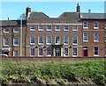
The Queen's Hotel - Public Houses, Inns and Taverns of Wisbech
This building was once The Queen's Hotel at 12 South Brink overlooking The River Nene. It traded as a hotel for about 20 years in the later part of the 20th Century. The photographer remembers this being a hotel. It has now reverted to its original use as a domestic dwelling. It is not listed in A A Oldham's book as it started trading after the book was written in 1950. It was documented trading in the 1994 CAMRA guide which also records it as being originally built in 1772. See http://media.geograph.org.uk/view.php?id=1834 which shows the hotel when it was still trading.
Image: © Richard Humphrey
Taken: 29 Apr 2016
0.03 miles
9
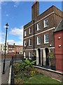
Octavia Hill's birthplace on South Brink in Wisbech
Octavia Hill was one of the founders of The National Trust
see https://en.wikipedia.org/wiki/Octavia_Hill and http://www.octaviahill.org/
The National Trust owns Peckover House over The River Nene on North Brink and also several hundred acres of adjoining land in Wisbech see http://www.geograph.org.uk/photo/5127967 & http://www.geograph.org.uk/photo/5534189 & http://www.geograph.org.uk/photo/2925442 & http://www.geograph.org.uk/photo/3155103 & https://www.geograph.org.uk/photo/5878709 & https://www.geograph.org.uk/photo/1504841
Image: © Richard Humphrey
Taken: 9 Sep 2018
0.03 miles
10

Former Boys' Grammar School
This former School situated on the South Brink, has now been converted to offices.
Image: © Tony Bennett
Taken: 14 Mar 2009
0.03 miles