
IMAGES TAKEN NEAR TO
School Lane, WISBECH, PE13 1AW
Introduction
This page details the photographs taken nearby to School Lane, PE13 1AW by members of the Geograph project.
The Geograph project started in 2005 with the aim of publishing, organising and preserving representative images for every square kilometre of Great Britain, Ireland and the Isle of Man.

There are currently over 7.5m images from over14,400 individuals and you can help contribute to the project by visiting https://www.geograph.org.uk
Image Map
Images are licensed for reuse under creativecommons.org/licenses/by-sa/2.0
Notes
- Clicking on the map will re-center to the selected point.
- The higher the marker number, the further away the image location is from the centre of the postcode.
Image Listing (782 Images Found)
Images are licensed for reuse under creativecommons.org/licenses/by-sa/2.0
Image
Details
Distance

3

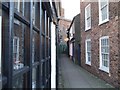
Institute clock and School Lane, Wisbech
Image: © Richard Humphrey
Taken: 27 Mar 2016
0.02 miles
4

Former school for girls in Hill Street, Wisbech
There is an inscription between the ground floor and first floor windows -
THE SCHOOL FOR GIRLS BUILT BY THE BURGESSES OF WISBECH A.D.1814 SUPPORTED BY THE BEQUEST OF MRS.E.WRIGHT AND THE BENEFACTIONS OF ABRAHAM JOBSON D.D., JOHN EDES, ESQ., AND OTHERS, AIDED BY VOLUNTARY SUBSCRIPTIONS
Image: © Richard Humphrey
Taken: 16 Mar 2020
0.02 miles
5

The Wisbech Institute Clock Tower and Hall
A view from the top floor of the Horsefair car park
Image: © Richard Humphrey
Taken: 22 Nov 2017
0.02 miles
6
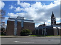
The Custom House Tavern (Site of) - Public Houses, Inns and Taverns of Wisbech
This is the site of a former tavern, The Custom House Tavern which was a beer house at No 1 Albion Terrace overlooking Albion Place and The River Nene. The position is shown on the map in AA Oldham's book and also in this photo http://media.geograph.org.uk/view.php?id=1047 by © Samuel Smith c1854.
Albion Terrace was demolished in the 1970s and government offices and part of The Horsefair car park and bus station now occupy the site.
Image: © Richard Humphrey
Taken: 4 Mar 2016
0.02 miles
7
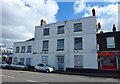
The Old Bell - Public Houses, Inns and Taverns of Wisbech
This building is a former coaching Inn and public house and is located at 16 Nene Quay, Wisbech. It was still trading in 1983 according to the guide published by the Peterborough branch of CAMRA. The photographer remembers this building being a pub before it was closed and converted into a block of apartments, which are now boarded-up.
It is named on the 1887 OS map of Wisbech, see https://www.old-maps.co.uk/#/Map/546227/310115/13/100091
Image: © Richard Humphrey
Taken: 4 Mar 2016
0.02 miles
8

Boarded up apartment block on Nene Quay, Wisbech (Formerly The Old Bell Inn)
According to the description in this listing http://historicengland.org.uk/listing/the-list/list-entry/1126631 this was once The Old Bell Inn
Not to be confused with The New Bell Inn, also on Nene Quay 150 yards to the right, see http://www.geograph.org.uk/photo/4749808
Image: © Richard Humphrey
Taken: 23 Nov 2015
0.02 miles
9

Wisbech Jobcentre Plus
The Institute Clock is in the distance
Image: © Richard Humphrey
Taken: 21 Mar 2020
0.02 miles
10

Dicken's Tavern, 17 Hill Street, Wisbech
Grade II* Listed mid 18th century house. From 1980 'Ernie's Place' Chinese restaurant that closed late 2011.
Image: © Jo and Steve Turner
Taken: 21 Apr 2018
0.03 miles