
IMAGES TAKEN NEAR TO
Priory Road, SPALDING, PE11 9ZN
Introduction
This page details the photographs taken nearby to Priory Road, PE11 9ZN by members of the Geograph project.
The Geograph project started in 2005 with the aim of publishing, organising and preserving representative images for every square kilometre of Great Britain, Ireland and the Isle of Man.

There are currently over 7.5m images from over14,400 individuals and you can help contribute to the project by visiting https://www.geograph.org.uk
Image Map
Images are licensed for reuse under creativecommons.org/licenses/by-sa/2.0
Notes
- Clicking on the map will re-center to the selected point.
- The higher the marker number, the further away the image location is from the centre of the postcode.
Image Listing (442 Images Found)
Images are licensed for reuse under creativecommons.org/licenses/by-sa/2.0
Image
Details
Distance

2

Abbey Buildings
Range of early 16th century monastic buildings adapted to form a terrace of 7 cottages
Image: © Richard Croft
Taken: 12 Feb 2009
0.03 miles
3

Abbey Buildings cottage
One of the cottages in Abbey Buildings http://www.geograph.org.uk/photo/1160115
Image: © Richard Croft
Taken: 12 Feb 2009
0.03 miles
4
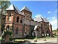
The old Johnson Hospital on Priory Road in Spalding
The old Johnson Hospital on Priory Road currently stands empty and boarded up. It opened in 1881 and closed in 2009. https://www.heritagesouthholland.co.uk/wp-content/uploads/2019/11/002-Old-Johnson-Hospital.pdf
Image: © Richard Humphrey
Taken: 16 May 2021
0.04 miles
5

Abbey Buildings off Priory Road in Spalding
A row of private terraced cottages possibly constructed out of the remains of part of the Priory. They are Grade II listed.
Image: © Richard Humphrey
Taken: 16 May 2021
0.04 miles
6
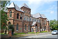
Former Johnson Hospital
Built and endowed by Misses EA and MA Johnson the hospital opened on 12th October 1881.
Image: © John M
Taken: 30 May 2014
0.05 miles
7

London Road, Spalding (3)
A fine display of Georgian houses facing the River Welland, mostly mid-C18th or early-C19th, and all Grade II listed. The far group is Welland Terrace, possibly by John Cunnington in 1813, and Grade II* listed.
Spalding is an attractive town which makes unusually good use of its river. Handsome buildings line either side facing each other across the river.
Image: © Stephen Richards
Taken: Unknown
0.05 miles
8

The old Johnson Hospital on Priory Road, Spalding
The old Johnson Hospital on Priory Road currently stands empty and boarded up. It opened in 1881 and closed in 2009. https://www.heritagesouthholland.co.uk/wp-content/uploads/2019/11/002-Old-Johnson-Hospital.pdf
Image: © Richard Humphrey
Taken: 16 May 2021
0.06 miles
9

London Road, Spalding (2)
A fine display of Georgian houses facing the River Welland, dating from the late-C18th or early-C19th (except for the late-C19th black and white projection). All are Grade II listed.
Spalding is an attractive town which makes unusually good use of its river. Handsome buildings line either side facing each other across the river.
Image: © Stephen Richards
Taken: Unknown
0.06 miles
10

London Road, Spalding (1)
A fine display of Georgian houses facing the River Welland. The group on the left is Welland Terrace, possibly by John Cunnington in 1813. The others range from the mid-C18th to early-C19th, and all are either Grade II or Grade II* listed.
Spalding is an attractive town which makes unusually good use of its river. Handsome buildings line either side facing each other across the river.
Image: © Stephen Richards
Taken: Unknown
0.06 miles