
IMAGES TAKEN NEAR TO
Church Lane, SPALDING, PE11 4UD
Introduction
This page details the photographs taken nearby to Church Lane, PE11 4UD by members of the Geograph project.
The Geograph project started in 2005 with the aim of publishing, organising and preserving representative images for every square kilometre of Great Britain, Ireland and the Isle of Man.

There are currently over 7.5m images from over14,400 individuals and you can help contribute to the project by visiting https://www.geograph.org.uk
Image Map
Images are licensed for reuse under creativecommons.org/licenses/by-sa/2.0
Notes
- Clicking on the map will re-center to the selected point.
- The higher the marker number, the further away the image location is from the centre of the postcode.
Image Listing (154 Images Found)
Images are licensed for reuse under creativecommons.org/licenses/by-sa/2.0
Image
Details
Distance
1

Ruby Hunt Centre
Originally a doctor's surgery, this building has evolved into a meeting place for village activities. It is named after a tireless local dignitary who was also a proficient local writer. It replaces a temporary building about a hundred metres distant.
Image: © Donnylad
Taken: 27 Apr 2006
0.06 miles

3

Footpath off Church Lane, Donington
Image: © Jonathan Thacker
Taken: 17 Aug 2019
0.08 miles
4

The institute
Built between the wars as the Church hall, which stands opposite the Church on Church Street, at the side of Church Lane. It is known by the older residents as, "The institute", due probably to the many clubs and societies that have used the building as their HQ. Many of them have fallen by the wayside over the years with dwindling membership, the Women's Institute however remains as resolute as ever.
Image: © Donnylad
Taken: 14 May 2006
0.08 miles
5

The Red Cow
This former coaching Inn is now in a poor state of repair. It was in its heyday when Donington used to stage massive horse fairs in the 19th & 20th centuries. It is said locally that the animals were stood for two miles in every direction awaiting their fate.
Image: © Donnylad
Taken: 27 Apr 2006
0.10 miles
6

Fire Station
Community Fire Station manned by retained volunteers. It stands almost across the High Street from the entrance to Flinders Park. The platform seen above the roof used to carry the 'buzzer', which was a former air raid siren used to alert the firemen of their required attendance, this method of alarm has now been replaced by the personal alert bleepers. What also has changed is that the once familiar sight of abandoned bicycles, wheels and pedals still spinning, has now been replaced by all modes of motor transport seemingly abandoned, doors wide open as the 'Shout' is answered.
Image: © Donnylad
Taken: 14 May 2006
0.10 miles

8

Methodist Chapel
This fine red brick Methodist Chapel stands on Church Street. It is one of three places of worship still used in the village.
Image: © Donnylad
Taken: 27 Apr 2006
0.10 miles
9
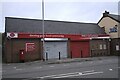
An inconvenience store
According to the company web site this store is open from 07:00 until 22:00. But in fact it is closed.
Image: © Bob Harvey
Taken: 6 Oct 2020
0.11 miles
