
IMAGES TAKEN NEAR TO
Brooks Court, SPALDING, PE11 3SY
Introduction
This page details the photographs taken nearby to Brooks Court, PE11 3SY by members of the Geograph project.
The Geograph project started in 2005 with the aim of publishing, organising and preserving representative images for every square kilometre of Great Britain, Ireland and the Isle of Man.

There are currently over 7.5m images from over14,400 individuals and you can help contribute to the project by visiting https://www.geograph.org.uk
Image Map
Images are licensed for reuse under creativecommons.org/licenses/by-sa/2.0
Notes
- Clicking on the map will re-center to the selected point.
- The higher the marker number, the further away the image location is from the centre of the postcode.
Image Listing (14 Images Found)
Images are licensed for reuse under creativecommons.org/licenses/by-sa/2.0
Image
Details
Distance

3
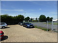
Gently - a Bentley
A repaired Bentley awaiting collection from AS Whittaker. The site is part of an industrial development that did not exist some 20 years ago.
Image: © Bob Harvey
Taken: 31 May 2017
0.03 miles
4

Vernatt's Drain
Heavily embanked, just over the fence from the industrial estate is the artificial river of Vernatt's Drain. I was disappointed not to be able to see the water, but this is now a very high embankment, much higher than when I was a lad.
Image: © Bob Harvey
Taken: 31 May 2017
0.04 miles
6
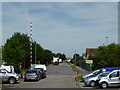
A short industrial road
The stubbe end of Stephenson Avenue
Image: © Bob Harvey
Taken: 31 May 2017
0.05 miles
7

Vehicle repairers
The local company of A S Whittaker Founded in 1920 by Albert Whitaker, and has grown in reputation and throughput, and now has branches not just in Spalding but in Huntingdon and Peterborough.
Image: © Bob Harvey
Taken: 31 May 2017
0.06 miles

10

River Welland at high tide.
Taken from the embankment at Fulney Lock. The branch to the right is the entrance to the Coronation Channel, built in 1953, to protect Spalding from floods. The new power station is visible on the opposite bank.
Image: © Kate Jewell
Taken: 19 Jun 2006
0.23 miles