
IMAGES TAKEN NEAR TO
St. Nicholas Way, SPALDING, PE11 3GF
Introduction
This page details the photographs taken nearby to St. Nicholas Way, PE11 3GF by members of the Geograph project.
The Geograph project started in 2005 with the aim of publishing, organising and preserving representative images for every square kilometre of Great Britain, Ireland and the Isle of Man.

There are currently over 7.5m images from over14,400 individuals and you can help contribute to the project by visiting https://www.geograph.org.uk
Image Map
Images are licensed for reuse under creativecommons.org/licenses/by-sa/2.0
Notes
- Clicking on the map will re-center to the selected point.
- The higher the marker number, the further away the image location is from the centre of the postcode.
Image Listing (6 Images Found)
Images are licensed for reuse under creativecommons.org/licenses/by-sa/2.0
Image
Details
Distance
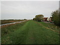
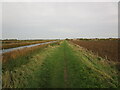
3
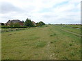
Houses near Vernatt's Drain, Spalding
Over the last few years housing development on the NW side of Spalding has spread as far as Vernatt's Drain. Houses are still being built in the area and I noticed one current pretentious marketing ploy is to advertise the houses as being next to Vernatt's "Waterway" - there's nowt wrong with a good old fen drain!
Image: © Richard Humphrey
Taken: 27 Jul 2011
0.18 miles

5
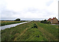
Vernatt's Drain, Spalding, Lincs
– view NE with Sorrel Drive below its bank.
Image: © Rodney Burton
Taken: 12 Aug 2006
0.23 miles
6
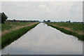
Vernatt's Drain, Spalding
Named after one of the civil engineers who drained the fens, Vernatt's Drain is a large waterway around the north-west of Spalding. It is part of the extensive Fens drainage network.
Image: © Kate Jewell
Taken: 7 Jun 2010
0.23 miles