
IMAGES TAKEN NEAR TO
Spalding Road, SPALDING, PE11 3DT
Introduction
This page details the photographs taken nearby to Spalding Road, PE11 3DT by members of the Geograph project.
The Geograph project started in 2005 with the aim of publishing, organising and preserving representative images for every square kilometre of Great Britain, Ireland and the Isle of Man.

There are currently over 7.5m images from over14,400 individuals and you can help contribute to the project by visiting https://www.geograph.org.uk
Image Map
Images are licensed for reuse under creativecommons.org/licenses/by-sa/2.0
Notes
- Clicking on the map will re-center to the selected point.
- The higher the marker number, the further away the image location is from the centre of the postcode.
Image Listing (36 Images Found)
Images are licensed for reuse under creativecommons.org/licenses/by-sa/2.0
Image
Details
Distance
1

Johnson Community Hospital: Diabetic Retinopathy screening
This mobile unit operates all over south Lincolnshire
Image: © Bob Harvey
Taken: 14 Mar 2016
0.01 miles
2

Johnson Community Hospital: Mobile breast screening van
There have been several of these trailers. This one is called "Primrose"
Image: © Bob Harvey
Taken: 14 Mar 2016
0.01 miles
3
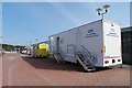
Johnson Community Hospital: Screening vans
The mobile screening units for NHS Lincolnshire go all over the county, but are frequently to be found here.
Image: © Bob Harvey
Taken: 14 Mar 2016
0.01 miles
4

Johnson Community Hospital: public car park
Image: © Bob Harvey
Taken: 14 Mar 2016
0.02 miles
5
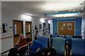
Johnson Community Hospital: Waiting room
This is the waiting room for Clinic 1
Image: © Bob Harvey
Taken: 14 Mar 2016
0.03 miles
6
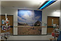
Johnson Community Hospital: waiting room
This is the waiting room for clinic 1, which is very imaginatively decorated.
Image: © Bob Harvey
Taken: 14 Mar 2016
0.03 miles
7

Embankment walk
This high embankment at the side of Vernatt's Drain, between Spalding and Pinchbeck, is a popular dog walking spot. The embankment itself is something of a puzzle, because flood precutions here are an obvious reason for building it, but it is not continuous either around the hospital site or along the drain, so it can have no purpose in water control. I imagine it was spoil from construction of the hospital.
Image: © Bob Harvey
Taken: 14 Mar 2016
0.04 miles
9

Johnson Community Hospital: entranceway
A view from outside the 'wind tunnel'
Image: © Bob Harvey
Taken: 14 Mar 2016
0.05 miles
10

Johnson Community Hospital: entranceway
Named in honour of the earlier 19th century Johnson Hospital in the centre of Spalding, this is a "nurse-lead" facility rather than a full blown general hospital. Having built a new general hospital (The Welland on Roman Bank) in the town in the 1960s which had to be demolished because of building errors the NHS did not want to fund a 3rd in 100 years, even though the town has doubled in size in recent decades.
This view is taken when walking out of the hospital.
Image: © Bob Harvey
Taken: 14 Mar 2016
0.05 miles