
IMAGES TAKEN NEAR TO
St. Thomas Road, SPALDING, PE11 2TJ
Introduction
This page details the photographs taken nearby to St. Thomas Road, PE11 2TJ by members of the Geograph project.
The Geograph project started in 2005 with the aim of publishing, organising and preserving representative images for every square kilometre of Great Britain, Ireland and the Isle of Man.

There are currently over 7.5m images from over14,400 individuals and you can help contribute to the project by visiting https://www.geograph.org.uk
Image Map
Images are licensed for reuse under creativecommons.org/licenses/by-sa/2.0
Notes
- Clicking on the map will re-center to the selected point.
- The higher the marker number, the further away the image location is from the centre of the postcode.
Image Listing (64 Images Found)
Images are licensed for reuse under creativecommons.org/licenses/by-sa/2.0
Image
Details
Distance
1
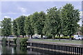
Row of lime trees along the Welland
A row of Lime trees planted after the flood defences were raised in 1953, and looking splendid. The columnar nature of them suggests they were a special cultivar, but I don't know which one.
Image: © Bob Harvey
Taken: 21 Aug 2022
0.05 miles
2

River Welland
View along and across the Welland to Cowbit Road
Image: © Richard Croft
Taken: 25 Sep 2008
0.06 miles
3
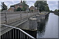
Entrance to the Coronation Channel
The concrete piers of the Cowbit Sluice. This is a diversion of the River Welland, seen on the right, along with the distant former railway bridge Image
Image: © Bob Harvey
Taken: 21 Aug 2022
0.07 miles
4

Former Welland pub
Splendidly restored former pub http://www.geograph.org.uk/photo/734654 on London Road, now a handsome private house.
Image: © Richard Croft
Taken: 10 Mar 2015
0.07 miles
5

The Welland
Closed pub on London Road in Spalding
Image: © Richard Croft
Taken: 18 Mar 2008
0.07 miles
6

The bridge over Cowbit Sluice
Cowbit Sluice is the point where the Coronation Channel carries diverted waters from the Welland round the outside of Spalding. The coronation referred to was, of course, in 1953 and that is when the diversion was created.
Image: © Bob Harvey
Taken: 21 Aug 2022
0.07 miles
7

Coronation Channel
View across the River Welland to Cowbit Road bridge over the Coronation Channel
Image: © Richard Croft
Taken: 25 Sep 2008
0.07 miles
8
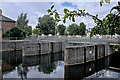
Cowbit Sluice piers
Although called a sluice, there are no sluice gates. The grooves in these bastions, or perhaps pontoons, or more probably piers will take portable sluice boards, just as when the Coronation Channel was cut, to allow the water to be removed for maintenance.
Image: © Bob Harvey
Taken: 21 Aug 2022
0.07 miles
9

Cowbit Road
Beyond the trees, the River Welland.
Image: © Bob Harvey
Taken: 21 Aug 2022
0.08 miles
10

The Barn
A large historic barn on Cowbit Road, in front of a large plant nursery.
Since 1904 C Slooten Ltd have specialised in supplying a wholesale shrubs, perennials and climbers into the plant trade.
Image: © Bob Harvey
Taken: 21 Aug 2022
0.08 miles