
IMAGES TAKEN NEAR TO
St. Andrews Road, SPALDING, PE11 2SJ
Introduction
This page details the photographs taken nearby to St. Andrews Road, PE11 2SJ by members of the Geograph project.
The Geograph project started in 2005 with the aim of publishing, organising and preserving representative images for every square kilometre of Great Britain, Ireland and the Isle of Man.

There are currently over 7.5m images from over14,400 individuals and you can help contribute to the project by visiting https://www.geograph.org.uk
Image Map
Images are licensed for reuse under creativecommons.org/licenses/by-sa/2.0
Notes
- Clicking on the map will re-center to the selected point.
- The higher the marker number, the further away the image location is from the centre of the postcode.
Image Listing (60 Images Found)
Images are licensed for reuse under creativecommons.org/licenses/by-sa/2.0
Image
Details
Distance

2
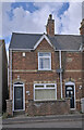
Dated terrace
Part of a terrace of three homes dating, according to the datestone, from 1898. See Image
Image: © Bob Harvey
Taken: 21 Aug 2022
0.07 miles
3
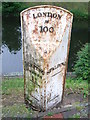
Old Milepost
Old milepost on what was the A.16 at Spalding, Lincolnshire. For overall view see http://www.geograph.org.uk/photo/4010310
Image: © Keith Evans
Taken: 27 May 2014
0.07 miles
4
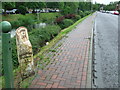
Milepost
Old milepost on what was the A.16 at Spalding, Lincolnshire. For close up view see http://www.geograph.org.uk/photo/4010305
Image: © Keith Evans
Taken: 27 May 2014
0.07 miles
5

Modern cottages
The brickwork style, eaves, and roofline of these houses makes them roughly contemporary with the ones in Image and Image, the first decade of the 21st century.
I got excited by the pale brick above the two porches, because I have a thing about datestones. But it isn't a datestone. See Image
Image: © Bob Harvey
Taken: 21 Aug 2022
0.07 miles
6

Branded Brickwork
I felt sure this odd brick would be a datestone, but I was wrong. It is something I have never seen before, a brick bearing the name of the developer, Fieldview Homes.
This is above the two porches in Image
Image: © Bob Harvey
Taken: 21 Aug 2022
0.07 miles
7
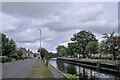
London road, Little London
The road alongside the River Welland was once the main road through Spalding.
In the distance the derelict railway bridge, seen in Image
Image: © Bob Harvey
Taken: 21 Aug 2022
0.07 miles
8

St Thomas' Road
This bit of road, and the footpath beyond, trace out the former route of the Railway that ran over the bridge in Image, Image, Image
Image: © Bob Harvey
Taken: 21 Aug 2022
0.08 miles
9

The Welland rail bridge
A footbridge is part of this structure, so looking through the lattice steel you can see the rails have been lifted. The deck timbers just here look sound but elsewhere are pretty rotten.
Image: © Michael Trolove
Taken: 20 Sep 2009
0.08 miles
10
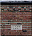
Datestone
Above the porch of the first house in Image is this datestone. I was also taken with the decorative coursework at the top, so I have included that. The bulk of the wall, however, is in stretcher bond.
Image: © Bob Harvey
Taken: 21 Aug 2022
0.08 miles