
IMAGES TAKEN NEAR TO
Mill Drove, BOURNE, PE10 9YE
Introduction
This page details the photographs taken nearby to Mill Drove, PE10 9YE by members of the Geograph project.
The Geograph project started in 2005 with the aim of publishing, organising and preserving representative images for every square kilometre of Great Britain, Ireland and the Isle of Man.

There are currently over 7.5m images from over14,400 individuals and you can help contribute to the project by visiting https://www.geograph.org.uk
Image Map
Images are licensed for reuse under creativecommons.org/licenses/by-sa/2.0
Notes
- Clicking on the map will re-center to the selected point.
- The higher the marker number, the further away the image location is from the centre of the postcode.
Image Listing (37 Images Found)
Images are licensed for reuse under creativecommons.org/licenses/by-sa/2.0
Image
Details
Distance
1
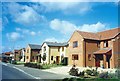
Mill Drove, Bourne, Lincolnshire
As the demand for new houses increased, Bourne started to extend out into the fen where developers were given permission in 1989 to build 300 new homes on thirty acres of agricultural land on the eastern end of Mill Drove, the streets being named after Second World War locations including the Battle of Arnhem in 1944 and the Burma campaign. The buyers have included a large number of retired people from the south east anxious to escape from escalating property prices in the London area.
Image: © Rex Needle
Taken: 18 Aug 2008
0.06 miles
2

Fields along Mill Lane Bourne
In the background can be seen Dyke Village. To the left of the picture and just out of view in this shot is The Car Dyke
Image: © Terry Butcher
Taken: 26 Feb 2006
0.06 miles
3

Car Dyke from Mill Drove
The Car Dyke is an artificial water channel, thought to have been constructed around AD125, which ran along the western Fen edge from Peterborough to Lincoln. It was approximately 15 metres wide at the top and between two and four metres deep. It is thought that its main purpose was to serve as a drain to control and divert flood waters, rather than as a navigable waterway along its entire length, although shorter sections could have been used for water transport.
This is Car Dyke seen from Mill Drove on the very edge of Bourne.
Image: © Marathon
Taken: 22 Feb 2014
0.08 miles
4
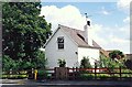
Railway gatekeeper?s cottage at Bourne, Lincolnshire
Whitewashed cottages were a feature of the Bourne to Sleaford railway line which opened in 1872 where gatekeepers lived with their families which enabled them maintain a continuous duty opening the level crossing gates whenever a train approached and closing them when it had passed. Most survived after the line closed in 1965 and were sold as private homes such as this one here in Mill Drove which has since been considerably extended.
Image: © Rex Needle
Taken: 18 Aug 1998
0.09 miles
5

Car Dyke from Mill Drove on the edge of Bourne
The Car Dyke is an artificial water channel, thought to have been constructed around AD125, which ran along the western Fen edge from Peterborough to Lincoln. It was approximately 15 metres wide at the top and between two and four metres deep. It is thought that its main purpose was to serve as a drain to control and divert flood waters, rather than as a navigable waterway along its entire length, although shorter sections could have been used for water transport.
This is Car Dyke seen from Mill Drove on the very edge of Bourne.
Image: © Marathon
Taken: 22 Feb 2014
0.10 miles
6
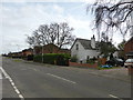
Crossing keeper's cottage
Mill drove is an old road and there was a level crossing here on the Bourne to Billingborough railway. The whitewashed house was the crossing keeper's home.
Image: © Bob Harvey
Taken: 23 Feb 2014
0.10 miles
8
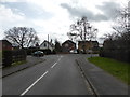
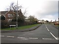
Stephenson Way
The red house is built were the trackbed of the Bourne to Sleaford railway ran. The road upon which I am standing is called, therefore, "Stephenson way" although there is little direct connection with the railway pioneer.
Image: © Bob Harvey
Taken: 23 Feb 2014
0.10 miles
9

Car Dyke from Mill Drove on the edge of Bourne
The Car Dyke is an artificial water channel, thought to have been constructed around AD125, which ran along the western Fen edge from Peterborough to Lincoln. It was approximately 15 metres wide at the top and between two and four metres deep. It is thought that its main purpose was to serve as a drain to control and divert flood waters, rather than as a navigable waterway along its entire length, although shorter sections could have been used for water transport.
This is Car Dyke seen from Mill Drove on the very edge of Bourne.
Image: © Marathon
Taken: 22 Feb 2014
0.11 miles
10
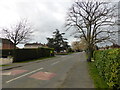
Mill Drove
Speed bumps were installed in Mill Drove and Beech Avenue about 10 years ago to stop them being used as rat-runs. There are lots of them.
Image: © Bob Harvey
Taken: 23 Feb 2014
0.12 miles