
IMAGES TAKEN NEAR TO
Yew Tree Close, BOURNE, PE10 9SW
Introduction
This page details the photographs taken nearby to Yew Tree Close, PE10 9SW by members of the Geograph project.
The Geograph project started in 2005 with the aim of publishing, organising and preserving representative images for every square kilometre of Great Britain, Ireland and the Isle of Man.

There are currently over 7.5m images from over14,400 individuals and you can help contribute to the project by visiting https://www.geograph.org.uk
Image Map
Images are licensed for reuse under creativecommons.org/licenses/by-sa/2.0
Notes
- Clicking on the map will re-center to the selected point.
- The higher the marker number, the further away the image location is from the centre of the postcode.
Image Listing (221 Images Found)
Images are licensed for reuse under creativecommons.org/licenses/by-sa/2.0
Image
Details
Distance
1

Chamerion angustifolium
At one point along this footpath the weed cover is this lovely drift of Rose Bay Willow Herb
Image: © Bob Harvey
Taken: 7 Aug 2013
0.01 miles
2

Ilex aquifolium
I very much suspect that this holly is not self-sown or wild. It is growing in the banks of the stream behind the houses in Beech Avenue, and is heavy with Berries.
Holly is dioecious, needing a male plant to polinate the female ones. There is a smaller Holly a metre behind - with no berries. I deduce that this is the male and I think it probable they were planted together by one of the householders.
Image: © Bob Harvey
Taken: 7 Aug 2013
0.02 miles
3

Holly Berries
These are the immature berries on the plant at Image
Technically Holly Berries are not berries, but Drupes. But who am I to argue with tradition and the broader public.
Image: © Bob Harvey
Taken: 7 Aug 2013
0.02 miles
4
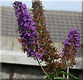
Working together
Large White butterfly (Pieris brassicae) and Honey Bee (Apis mellifera) both on the same head of a wild (or self-sown) Buddleia.
Image: © Bob Harvey
Taken: 7 Aug 2013
0.02 miles
5

Lightspeed FTTP internet provider
This sign on the barriers at Image says that the work is being done by Lightspeed, a company bringing improved fibre optic internet to this part of the world (https://www.lightspeed.co.uk/ ). The sign says "Bringing full fibre gigabit broadband with blistering speed to your street".
FTTP is "Fibre To The Premises", the complete elimination of copper pairs for internet connectivity, replacing it with fibre optic light guides. Currently the town is blessed with FTTC "Fibre To The Cabinet", leaving the infamous 'last mile' (in reality the last kilometre) to be done on a metallic connection
Image: © Bob Harvey
Taken: 23 Jul 2021
0.02 miles
6

Clematis x triternata
These delicate little flowers were on a climbing plant draped over the top of a back garden fence. The flowers are blooming happily on the north-facing side of the fence.
The plant can be seen on the left in Image]
Following an appeal on the discussion board this was identified for me by user 'grandturzel', to whom I offer thanks for the assistance.
Image: © Bob Harvey
Taken: 7 Aug 2013
0.02 miles
7

Overgrown stream
The footpath next to this stream is narrow, and the stream banks lush with weeds. Occasionally the authorities will cut things back to allow the footpath to be used. It is very popular with dog walkers heading to Bourne woods
Image: © Bob Harvey
Taken: 7 Aug 2013
0.02 miles
8
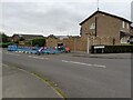
Work going on
The pavement is closed in Hazelwood Drive which also blocks access to the public footpath behind these houses (see Image). For more details see Image
Image: © Bob Harvey
Taken: 23 Jul 2021
0.03 miles
9
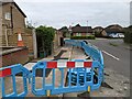
Fresh tarmac
Inside the barriers at Image you can see where the work has been done. Fresh ductwork between the cable pit and the roadside cabinet, both parts of the telephone distribution network.
Image: © Bob Harvey
Taken: 23 Jul 2021
0.03 miles
10

Start of Hazlewood Drive
One of the last developments in the North West corner of Bourne, a large estate of small roads between Beech Avenue and Conjury Nook farm.
The brick wall in the foreground is the parapet of the bridge (or culvert) that takes the stream from the Chalybeate well field into town.
Image: © Bob Harvey
Taken: 7 Aug 2013
0.03 miles