
IMAGES TAKEN NEAR TO
Cedar Drive, BOURNE, PE10 9SQ
Introduction
This page details the photographs taken nearby to Cedar Drive, PE10 9SQ by members of the Geograph project.
The Geograph project started in 2005 with the aim of publishing, organising and preserving representative images for every square kilometre of Great Britain, Ireland and the Isle of Man.

There are currently over 7.5m images from over14,400 individuals and you can help contribute to the project by visiting https://www.geograph.org.uk
Image Map
Images are licensed for reuse under creativecommons.org/licenses/by-sa/2.0
Notes
- Clicking on the map will re-center to the selected point.
- The higher the marker number, the further away the image location is from the centre of the postcode.
Image Listing (1785 Images Found)
Images are licensed for reuse under creativecommons.org/licenses/by-sa/2.0
Image
Details
Distance

2

Field entrance
A 'slice' of agricultural land was sold to build Cedar drive, but the farmer still needs access. so there is a gap between the houses for the machinery to be brought in a few times a year.
Image: © Bob Harvey
Taken: 6 Aug 2013
0.02 miles
3
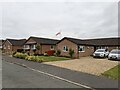
St George's Flag
A flagpole and the flag of England.
Image: © Bob Harvey
Taken: 23 Jul 2021
0.03 miles
4
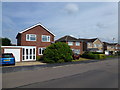
The Beech Avenue Magnolia
The magnolia in this front garden was planted by the first family to move in. I've walked my dogs past it for years, and for a long time it was a poor old thing with widely spaced branches and lots of fresh air. I think it suffered some frost damage in its first decade.
But now it is magnificent. A superb, rounded, shape of a tree and still some late flowers on it.
Image: © Bob Harvey
Taken: 7 Aug 2013
0.03 miles
5
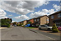
Cedar Drive
Houses in Cedar Drive, which has 2-storey houses on one side and Bungalows on the other. This road was built in the 1980s.
Image: © Bob Harvey
Taken: 18 Aug 2013
0.03 miles
6

Old boundary
In the corner of this field is a length of dyke and a few trees left over from an old hedge. The line runs North-South, and is a fragment of a former boundary.
Image: © Bob Harvey
Taken: 6 Aug 2013
0.04 miles
7
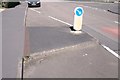
Bollard and false kerb
The false kerb at Image showing the small culvert with a steel cap that ensures pools of rainwater do not form behind the kerb piece.
Image: © Bob Harvey
Taken: 29 May 2020
0.05 miles
8
An isolated corner
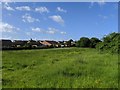
Part of the adjacent Blind Well field seen in Image and Image as far as the landowner is concerned but separated from it by the section of hedge running roughly north-south on the right here. When sheep were grazed in that field it formed a sheltered area for them.
That old hedge is a lost boundary, that can be traced through Bourne to the path seen in Image where this forgotten alignment also exists.
Image: © Bob Harvey
Taken: 23 May 2020
0.05 miles
9
Controlling things
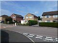
There are 16 sets of these concrete speed bumps in Beech Avenue, all of them with some sort of false kerb to narrow the road. This one has a particularly large chicane island. They were put in to stop people using the road as an unofficial bypass, and it certainly seems to have worked.
When this estate was built there was a covenant on the houses preventing the front gardens being enclosed. Nowadays nearly everyone has some sort of fence or hedge, but not many are fully gated like the two adjacent houses here.
Image: © Bob Harvey
Taken: 7 Aug 2013
0.05 miles
10

Extended house
Built in the 1980s, but extended in the late 2010s.
Image: © Bob Harvey
Taken: 29 May 2020
0.05 miles