
IMAGES TAKEN NEAR TO
Burghley Street, BOURNE, PE10 9NS
Introduction
This page details the photographs taken nearby to Burghley Street, PE10 9NS by members of the Geograph project.
The Geograph project started in 2005 with the aim of publishing, organising and preserving representative images for every square kilometre of Great Britain, Ireland and the Isle of Man.

There are currently over 7.5m images from over14,400 individuals and you can help contribute to the project by visiting https://www.geograph.org.uk
Image Map
Images are licensed for reuse under creativecommons.org/licenses/by-sa/2.0
Notes
- Clicking on the map will re-center to the selected point.
- The higher the marker number, the further away the image location is from the centre of the postcode.
Image Listing (1493 Images Found)
Images are licensed for reuse under creativecommons.org/licenses/by-sa/2.0
Image
Details
Distance
1

Exeter Row, Bourne, Lincolnshire
In past times, the land to the west of North Street was occupied by low standard housing occupied by working class families but towards the end of the 19th century new developments began to change the area, notably the building of this attractive crescent of cottages in what is now Burghley Street. Exeter Row is so named because these houses were the first to be built there circa 1870 by the Marquess of Exeter, Lord of the Manor of Bourne, originally as cottages for artisans and now privately owned. These terraced cottages occupy one of the most prominent positions in Bourne and the attractive white frontage gives them a distinguished appearance on a sunny day.
Image: © Rex Needle
Taken: 17 Jun 2010
0.01 miles
2

Hidden assets
Clare Court, a block of small apartments
The British Legion clubhouse.
Both hidden away in Burghley street, out of sight of the rest of the town.
Image: © Bob Harvey
Taken: 7 Aug 2013
0.01 miles
3

The Burghley Street warehouse, Bourne, Lincolnshire
This old four-storey building just a short step from the town centre began life in the early years of the 19th century as a grain warehouse when Bourne had a flourishing corn trade but has since had several other commercial uses such as a maltings, flax factory and animal feed store. In 2008, the warehouse was bought by South Kesteven District Council for £350,000 as part of the proposed redevelopment of the town centre which subsequently fell through but the council used this and other nearby properties for a less ambitious scheme to provide 14 private flats and an arcade of seven shops of which the newly refurbished warehouse now forms part.
Image: © Rex Needle
Taken: 1 Jul 2014
0.01 miles
4

Burghley Street warehouse at Bourne, Lincolnshire
The early 19th century corn warehouse in Burghley Street stood empty for several years until bought by South Kesteven District Council for redevelopment and work began in the autumn of 2012 to turn the building into flats with an accompanying arcade of shops. See Image
Image: © Rex Needle
Taken: 1 Oct 2009
0.01 miles
5

"Bungalow Corner"
My father was a pre-war veteran of the Isle of Man TT, and called this dangerous little bend 'Bungalow corner' with his customary dry wit.
Image: © Bob Harvey
Taken: 11 Dec 2012
0.02 miles
6

The old Masonic lodge at Bourne, Lincolnshire
The Hereward Lodge was formed in 1868 but members did not get their own premises until 1938 when a lodge was built in Wherry’s Lane at a cost of £1,500. In recent years, it was described as the most unattractive building in town yet remained in use until demolished in 2010 to make way for a new shopping precinct and the lodge now occupies a more modern Masonic centre in Roman Bank. See the new Masonic Centre Image
Image: © Rex Needle
Taken: 21 Aug 2000
0.02 miles
7
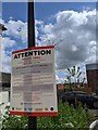
We don't like your sort round here
The grumpy notice seen in Image is not alone. They have been put up at every opportunity. I am puzzled by this. Why not a coded barrier if they are so frightened by strangers using the parking places? Why this thuggish enforcement system instead of controlled entry? Can it be with fines this high that enforcement is a more profitable approach than prevention?
Image: © Bob Harvey
Taken: 20 Jun 2020
0.02 miles
8

Royal British Legion club at Bourne, Lincolnshire
The Royal British Legion headquarters is a useful rather than attractive building, opened in 1980 at a converted corn warehouse in Burghley Street previously occupied by the East Midlands Electricity Board's social club and now with later additions to the side and rear to provide the modern facilities required under the regulations for a licensed bar and clubroom.
Image: © Rex Needle
Taken: 12 Nov 2000
0.02 miles
9

New development
I've been away. I knew that the rest of the Wherry's Lane site was going to be redeveloped, but I got home and found this bunch of buildings has appeared.
See Image for the eventual outcome
Image: © Bob Harvey
Taken: 14 Jun 2019
0.02 miles
10
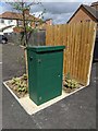
Pumping station
In the middle of the carpark at Image is this sewage pump control box. Why it could not have been inside the adjacent compound, only the gods of builders know.
Bourne is flat, on the edge of the fens, and there is very little natural fall for black water to the treatment works on the edge of town. Perhaps a metre or so in 2km. With the crowding in of new housing in the town centre, some boosting was inevitably required, and this is a sensible provision.
Image: © Bob Harvey
Taken: 20 Jun 2020
0.02 miles